 | CANADA |
ST IRENEE
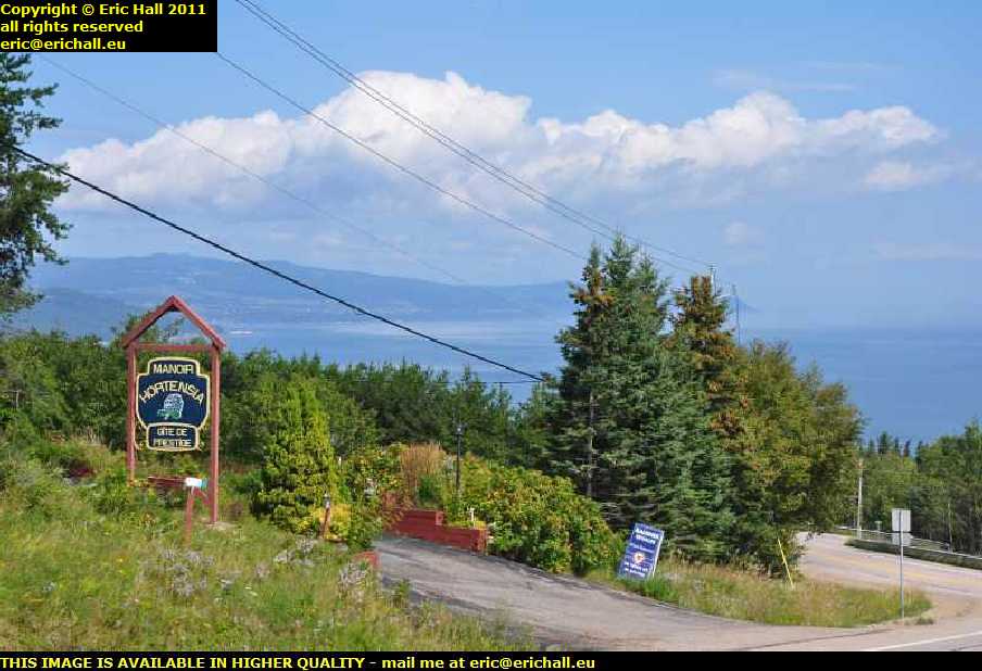
After my visit to Cap-aux-Oies in early May 2012, I return of Highway 362 where I join up with my other drives along that road in October 2010 and September 2011.
In 2010 I was really pushed for time on my way to Labrador and I remember musing to myself that here on the north bank of the St Lawrence, every village deserves its photograph. However I didn't have much time to waste and it was already going dark by the time that I was driving along here.
Nevertheless, here in the gathering gloom of the evening, the sun was so low in the sky that it had passed behind the Cap aux Oies and we were in the shadow, but the evening sunlight was streaming down upon the south bank of the St Lawrence, with the Appalachians in the background.
If anything was ever worth a photo, then this was it and I gladly took a minute or two out of my hectic schedule to capture it all on camera.
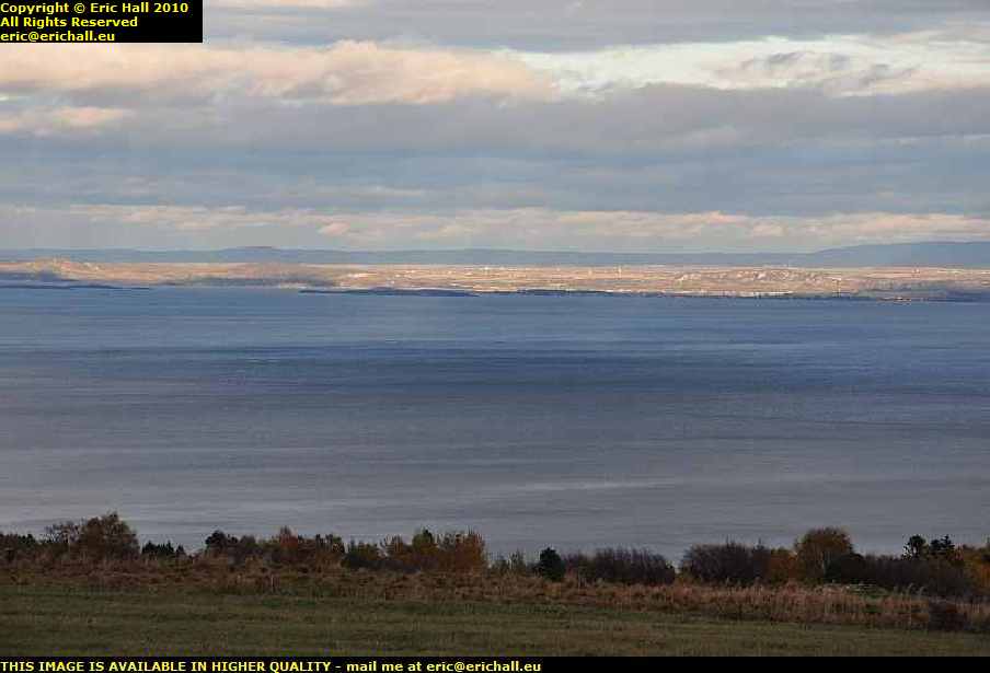
Not even a couple of minutes later, with the light fading even faster, rounding a bend in the road at Cap de la Corneille brought me face-to-face with this splendid view of St Irenée in the centre-left, Pointe-au-Pic in the dead centre, and La Malbaie slightly to the right of centre.
For once, I had the lighting conditions absolutely perfect for a photo such as this, and this is as good as any of the shots of this area that I have taken. All I really needed at the time was an extremely long zoom lens, and that was rectified for my visit of 2012. It was a shame that I didn't have the correct weather conditions then, but you can't have everything.
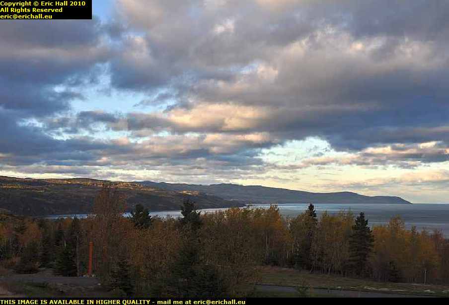
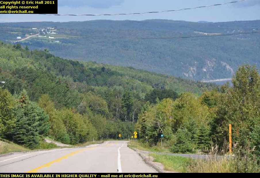
If you were with me in this morning's drive around Baie St Paul during my visit of 2011, you will remember that I was being chased along the road by a series of rolling clouds. Once I made it round the headland at Cap de la Corneille the cloud remained behind and I drove into dramatically different weather. The sun was out, the skies were clear, and that always makes me feel better.
Under the sparkling sunny skies, this part of the road was extremely pretty, as if the bit that we have been driving over isn't pretty enough. The next few miles along the north shore of the St Lawrence is the part that, for me anyway, makes Charlevoix one of the most beautiful regions in the whole of the world.
Somewhere way over there is the town of La Malbaie, and that's the last town of any real importance along the north shore until you reach the industrial centre of Baie Comeau, several hundred kilometres away.
Here's another view from a different spec a little further along the road. The first bay that you see, the one in the foreground, is where I reckon that St Ireneé might be, and that's one of the most beautiful villages along the most beautiful stretch of coastline, and the second bay is where I reckon that La Malbaie might be.
In fact, I think that La Malbaie might well be what looks like the cluster of buildings on the very far shoreline just to the left of the tall trees.
Once more bewitched by the beauty of the bay - "have you been at the battery acid again?" ...ed - I come to yet another stop alongside the highway just here. I think that down there at the bottom of the hill at the head of that bay is where I might find St. Irenée.
I'll also see if I can find out anything about that settlement at the top of the hill just there. I do remember from my flying visit here in 2010 on my way to the the Trans-Labrador Highway that the climb out of the village is one of the steepest I've ever seen, and maybe that road up there might be the road out.
But if it isn't the road out, then I'll be driving along the coast for a lot further than I think and so I cropped out of the above image a little section just to show you what the coastline looks like down there. And if that isn't a road along the shoreline down there, then by now you don't need me to tell you exactly what it might be.
Nevertheless, I'm being really spoilt for choice with all of the magnificent views along here, and you lot are certainly having your money's worth, the more I drive around here.
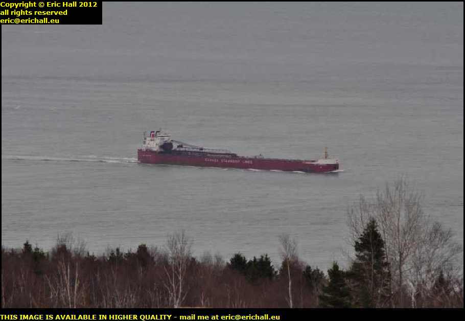
Advancing the clock forward to May 2012 however, this is the first ship of the day, if you don't count the Atlantic Superior that woke me up that morning .
She's the Canadian Steamships Line's CSL Laurentien, and was built as long ago as 1977 in Collingwood, Ontario, but prior to a major rebuild over the winter of 2001-2001, she was known as the Louis R. Desmarais.
She's what is known as a bulk self-offloader, meaning that she can load and unload cargo from ships that are anchored offshore, without any port facilities. According to her ship's log, she seems to spend much of her time running some kind of shuttle up and down the St Lawrence.
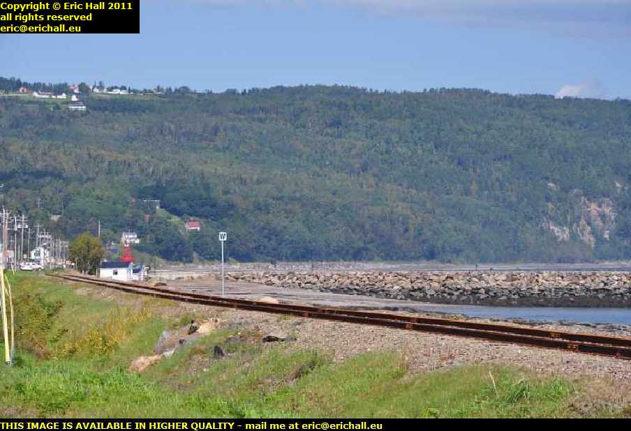
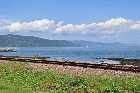
Anyway, we finally arrive at St. Irenée, which you can see just to the extreme left of the image. Off to the right is a stone pier.
Situated up there on the cliff overlooking St Irenee is that settlement that I was talking about just now. I mustn't forget to go for a wander around up there by the way and see what there is to see, seeing as how that is something that I have managed not to do on any of the numerous occasions that I've passed through here.
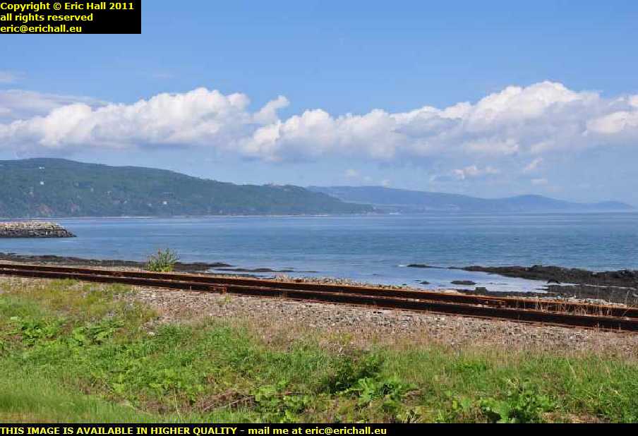
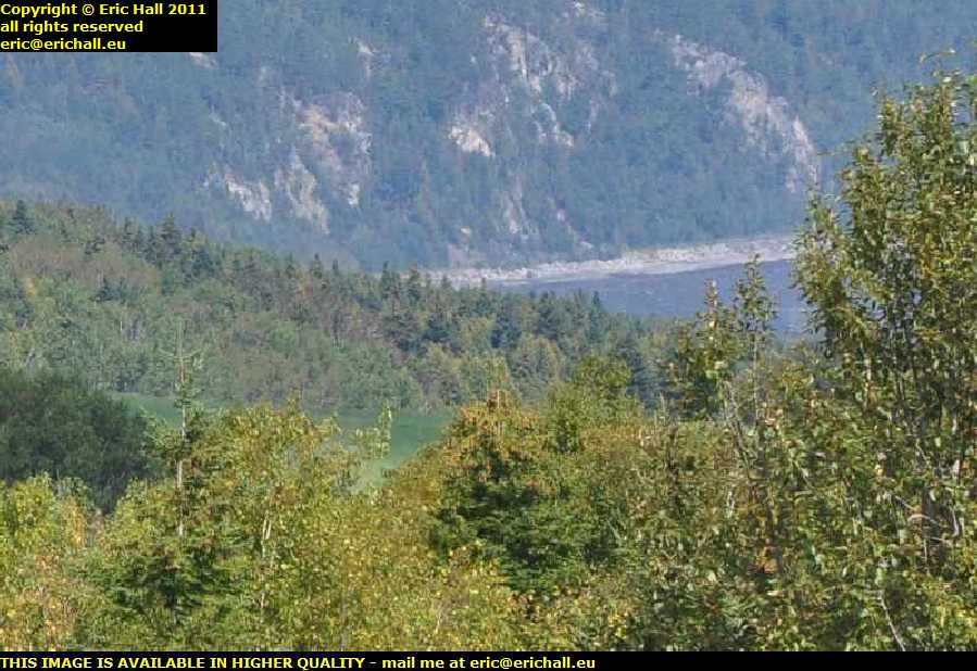
Here's our ephemeral railway line again, passing along the shore here, and looking across the railway line we can see the far end of the stone pier and then, across the bay, we have La Malbaie and way beyond along the St Lawrence to St Simeon, the Sauguenay River and other places further east.
This photo will give you all a really good idea of just how magnificent everything is all along here.
As for the pier, that's not really the end of it. I once saw a historic photo which showed that there was a pavillion down at the far end, but on 5th February 1945 a severe storm washed away the final few dozen metres and that really was the end of the pier. All pleas to restore it fell on deaf ears
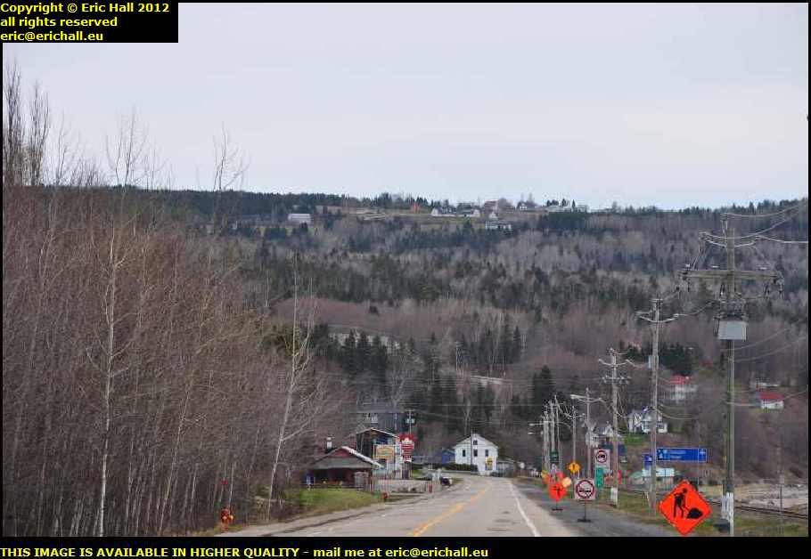
This photo however is not quite so good as the previous few. It's from the beginning of May 2012 as you might tell, given the sad state of the vegetation at the moment. At least the absence of foliage and so on gives us a much better view of the settlement up there.
On the other hand, we have a load of roadworks in our path and all of the signs are cluttering up the view. A petrol-engined stihlsaw would come in handy at moments such as this, and I do remember the time that my mate Paul came on an aeroplane from Liverpool to Charleroi clutching a petrol-engined stihlsaw in his sweaty little mitts. However such is the hysteria, panic and fear instilled into western citizens by the fascists in charge of the various western nations today that such a thing, considered normal practice back in 2000, would prompt a panic attack and a military intervention in the airport today.
Meanwhile, leaving politics behind and returning to our little journey, if you look above the white building in the centre of the photo near the bottom, you'll see the road winding its way up the hill towards the houses on the clifftop. That's the way that we are going to leave here.

However in the absence of the sun, but having a high-quality lens on my Nikon D5000
, a little bit of judicious cropping, sharpening and colouring can produce a decent image of the hub of the village, if you don't mind the odd power cable or two dozen in the shot.
Fuel back in May 2012 was 138.4 as you can see at the petrol station down there, next to the motel. That's a far cry from the 99.9 I was paying in the back end of Ontario in November 2010.
The Western nations' machinations in the Arab world look all very good on paper, but it's really just 19th Century warfare. The Arab nations are retaliating with 21st Century economic warfare, turning the screw even tighter in the oilfields, sending the price of oil soaring and sucking much of the western wealth back into the Middle East, bankrupting many western countries as we have already seen.
John Wayne, the 7th Cavalry and the US Marines aren't going to save this lot.
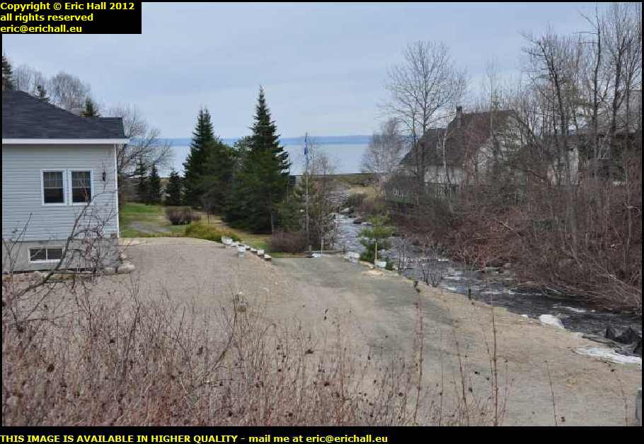
So abandoning yet another good rant until a more-appropriate moment, we'll continue our little perambulation around St Irenee. The village is situated where the Rivière Jean-Noël - whoever Jean-Noel might have been - cleaves its way through the mountains and into the St Lawrence.
It looks quite pretty, this river, but don't let appearances fool you. There's an organisation called OBV Charlevoix Montmorency - the Organisme de Bassins Versant Charlevoix Montmorency. It is charged with the task of overlooking water as a natural resource in the area. A report was published by this organisation on 22nd February 2012 concerning the river here, and basically, it considers the river to be disgusting. And that is mainly due to things like poor agricultural practice, non-conforming septic tanks and other sanitary installations, and poor standards of construction.
I saw part of the précis of this report, dating from 2011. One of the items, number 7 I believe, states quite clearly that one of the causes of pollution of the river is the practice of discharging waste water directly into the system because of the absence of a treatment plant, due to, if I allow myself to do the translation, "the cost of the infrastructure". Money and finance come before everything else, including unfortunately the environment.
In other words the report implies that it is a classic case of what is known in the francophone world as je m'en foutisme, or "I couldn't care less" by the very people who ought to be concerned in the tourism potential of the village and the health of its inhabitants.
So having noted the principle of "I'm all right Jack" that seems to exist in the area, why don't we turn our backs and look the other way, like everyone else around here seems to be doing, and talk about the history of the village?
Much of the history of the town is tied up with La Malbaie because when the area was divided up into the various Seigneuries in the 1650s, this area was included in the Seigneurie of La Malbaie.
Not much was kept in the way of records in the early days. It wasn't until 1774 that some kind of register was begun
As the Seigneurie expanded in population, the larger settlements distant from the hub of La Malbaie were detached to form their own parishes, and this was the case for St Irenee which was detached by proclamation of 8th May 1843 and which beats out the boundaries of the parish in delightful terms such as
" from the St Lawrence River along the line of division between the land of Antoine Girard and that of Grégoire Tremblay in the 1st concession".
The parish register was however started the previous year under Louis Alexis Bourret, the parish priest, and the first marriage in the new parish took place on 10th January 1843.
By 1860 the parish could count about 1,000 inhabitants and what one immediately notes from the records is that many of the households had an impressive number of inmates, 12 being not unusual. In the census of 1890, where the figures were more precise, there were 1100 inhabitants in 194 families.
Mind you, large families are often the norm in what might loosely be called "dissident" regions where it is often said that the battle for power will be fought not on the streets but in the cradle.
The typical type of house was long, low, spacious and with a thatched roof and had a vegetable garden where crops such as potatoes, carrots and lettuce might be grown, and small-scale farm animals might be kept.
It was said that despite the rocky nature of the soil, it was quite fertile, so much so that wheat and oats might be grown on some kind of large scale if a two year crop rotation cycle were employed, leaving the field fallow each alternate year.
Hard cash back in those days was quite another thing and barter was the usual method of obtaining goods that one did not have. As a consequence, many of the inhabitants, children as well as men and women, would have in addition to their normal occupations a little sideline such as knitting, lacemaking or shoemaking to quote just three examples, where they would produce (luxury) goods that would be in demand by their neighbours.
There is of course a church here in St Irenee and just as you might expect in Quebec, it fell victim to a fire, an event which occurred in March 1866. Luckily (or maybe not because you already know my opinion of Victorian church architecture) the damage was slight. Only the sacristy was affected, and the rest of the building was saved.
It was shortly after this that the church took out a fire insurance policy - a classic case of "closing the stable door after the horse has bolted" if ever I saw one.
All of this did rather remind me of the story that I heard about the fire that broke out in the main income tax office in Quebec, but due to the rapid response of the fire brigade it was extinguished before any serious good was done.
Other notable dates to remember in the history of the village include 2nd May 1896, when the Municipal Council agreed to the linking of the village to the the nascent national telephone system, and 11th March 1930 when the Municipality signed a contract with the Labrador Electric and Pulp Company for the supply of electricity.
St Irenee was also the site of an important Hotel, the Hotel Charlevoix of 75 rooms, but you really don't need me to tell you what happened to it, do you? The loss of the hotel, in May 1946, during a meeting of the Knights of Columbus as it happens, had a major and negative impact on the economic life of the village, from which it hasn't really recovered.
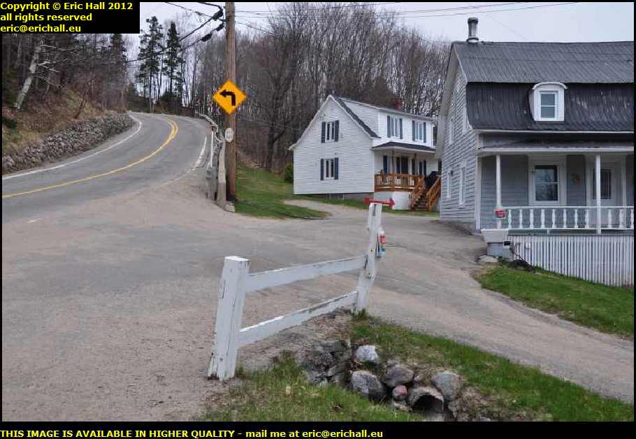
So as far as St Irenee is concerned, that is almost that. In whatever vehicle I was in whichever year that I was passing through here, I climbed up the steep hill that you saw in the photo just now and headed off towards La Malbaie, in 2010 passing one of those weird motor tricycles that was heading my way.
But if you want to stay around here for a couple of hours longer, come with me and explore the mystery of the enigmatic Rodolphe Forget and I'll finally tell you all about the history of his famous railway.
©