
|
CHEMIN DU ROY |
|
|
CHEMIN DU ROY |
THE CAPE OF GOOD HEALTH
The Motel Sous Les Charmilles where we stayed in April 2012 is situated just outside Portneuf, which means that it is situated just inside the limits of Cap Santé. I've translated that, as some kind of play on words, as the Cape of Good Health.
So our mission for today, if we chose to accept it, is to go for a good look around Cap Sante.
We don't actually travel very far though before we are side-tracked. Just after the Motel Sous Les Charmilles, there's a big old building set back from the modern road behind an earthen bank behind a little stone wall.
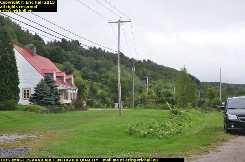
This immediately suggested to me that there has been the course of an old public highway, maybe the old Chemin du Roy right in front of the house.
My suspicions were further aroused because just a little further on there's a deviation off the modern road that follows the line of this old track. You might just be able to make out the hard surface to the left of the electricity pole and to the right of the house.

I went for a little wander along the road, even if it doesn't look as if it's been repaired since 1734, to see what I can see. And while there wasn't anything specific, there was a further clue to help me
This little bit of road is called rue de l'Anse - Street of the Cove, and that's very suggestive. A cove is, as you know, a small, sheltered bay. So, therefore, this road must have had some kind of connection to a small sheltered bay at the time that streets and roads were being given names
Had there been another road between this one and the shoreline, say, following the track of the present-day Highway 138, it would have been that one that would have had the connection to the cove, not this one.

Down at the far end of this old road, we rejoin the modern highway, but on our right there's another turning off - the rue des Aulnes. That seems also to be lined up with our older road, but it's clearly marked as a "rue Privée" - a private road - and so it's not possible to go for an exploration down there either.
However you will observe that where the wrapped hay bales are in the centre of the photo, that's in a perfect line with the road so it is suggestive of a continuation of the old highway. It's now in private hands and so exploration was not really possible.
However, here's a bit that we can drive along.

The Chemin du Roy takes us away from Highway 138 and round right along the headland here overlooking the St Lawrence. The houses here are said to be mainly from the 18th century and to represent the Inspiration Française
This lot here don't look very 18th century and certainly don't look like anything that I have ever seen that is typical of France, but you have to admit that the setting is cetainly spectacular. Not many of us could afford the mortgage on any kind of property in a place like this.
It's certainly spectacular around here, so much so that the Toronto Globe and Mail listed the road just here as being one of the 20 most picturesque roads in the whole of Canada.

If you stay on the old Chemin du Roy you eventually arrive in what is the centre of the village of Cap Santé. Here, you will encounter a village square that is certainly among the nicest that I have seen. They have cetainly put some effort into this place.
There are several fairly modern properties in the square but one or two of them seem to be quite traditional. I would have loved to have seen this place back in the early 19th century before they began the programme of the redevelopment of the Province. It must really have been something.

At the back of the square is the church and I have to do some careful manoeuvring to take this photo. From the best viewpoint, I had the sun streaming right into the camera lens.
The church was built in 1755 and is said to be inspired by the Basilica of Notre Dame, but not as usual of Montreal but this time of Québec. What do you think?
Anyway, its fame is that it is the last important one of the classic Quebec-style of churches to be built under the French regime.

What did catch my eye in the above photo was the road at the side of the church. It disappeared into nothingness with the view of the St Lawrence in the background and I reckoned that that might be worth further investigation.
I wasn't wrong either. The descent was certainly spectacular and it made me wish very much to be back here in late January or early February to see how the occupants of those houses down there managed the ascent - and the descent too. Not for the faint-hearted, I shouldn't think.

In late April 2012 there are no such problems though (although that might have been different the previous day in that snowstorm that we were having) and I was soon down at the bottom. At least, the view up to the top from down here had given me the best view of the church that I am likely to have. For once, the overhead power lines merge into the background and don't spoil the shot.
You can also make out how steep the descent is by looking at the diagonal line of vegetation below the right-hand tower of the church.

Just one meander in the whole of the St Lawrence downstream from Montreal, so they way. And that's it up there. We're looking towards the town of Portneuf by the way, just outside which town we spent last night. And if I had known how beautiful it was down here, I would have come down here last night and slept in the Dodge.
The railway line there was built in 1907, so they say. With it linking the three most important places in the Province of Québec, that's quite late for a main-line railway. But just by looking at this photo you can see some of the obstacles that they had to surmount. It can't have been easy to build this line.

You can see just how bitter the weather was, simply by looking at this guy collecting driftwood, of which there is an enormous quantity just round here. No-one will be short of firewood, so good luck to those who take it.
But you can see the guy swinging his axe for all he is worth and he has already cut an enormous pile, but here's there in overcoat, gloves and tuque - the woolly hat. He'll certainly need the firewood in this kind of weather.
It's not actually the cold that's the issue here either - it's this dreadful biting wind that's blowing right through my hat and freezing off my ears. And I know that I've said it before - "and you'll say it again too" ...ed - but in this absolutely, utterly and completely wicked wind, there is not a wind turbine anywhere. It's totally astonishing how much wind energy - and how much money and how much profitability - the local inhabitants are wasting.

While I was photographing all of this, we had a ship come along to say hello, so "hello ship", because she's come all the way from Lymany in the Ukraine just to see us. It's nice to put our Ship of the Day out of the way so early.
The ship is an oil and chemical tanker called the Songa Diamond of 11250 tonnes. Built as recently as 2009 with a length of 144 metres, a breadth of 21 metres and a draft of 9 metres, she's flying the flag of the Marshall Islands and is on her way to Trois Rivières and then to Montreal.

After this little interlude I drove back up the hill to the square. My preoccupation right now was to find the old trace of the Chemin du Roy, and it seemed reasonable to consider that if I were to continue in a straight line from the road that brought me into Cap Sante, I might be in the right area.
Putting that theory into practice, I found myself heading into a school yard that a barrier across it to prevent ingress. It was clearly not possible to do any further exploration, so I was obliged to retrace my steps back to the town square and think again.
Next time I pass by here, I'll bring Paul Simon and Julio with me.

A little wandering around found me looking at the road that was cliimbing up that hill over there. It certainly looks interesting up there and I could well imagine a diligence and team of horses struggling up that bank in mid-February, in a blizzard and six feet of snow.
It's certainly indicated as being part of the old Chemin du Roy. Early civil engineers did have something of a sense of humour, and I don't think that Lanouiller would have been any different. We mustn't forget either that people were much hardier 250 years ago than they are today. Our generation has grown quite soft if you ask me.

The Dodge climbed up here much easier than a diligence and team of horses, and while I was up here, my attention was drawn to this beautiful old house here.
It's the maison Page-Rinfret and the notice board informs us that it was constructed round about 1730. That ties in with the date of construction of the Chemin du Roy. The edifice is a National Historical Monument and I can't say that I'm surprised.

At the far end, the road swings round to rejoin the modern HIghway 138 but if you were to continue in a straight line instead, you would find yourself driving alongside that line of trees to your right and with that little embankment to your left further down, and you'd be driving on traces of old gravelled road as you can see right here.
This is all reasonably suggestive, isn't it?
While I had been driving, I had been thinking too. Despite being a man (or at least, I was last time I looked), I'm capable of multi-tasking.
What I was thinking of was the name of the place just here - Cap Santé, or the Cape of Good Health. It made me wonder why it was so named - Good Health as compared to what?
If they were celebrating good health, then surely they must have been having to deal with ill-health issues, and plenty of them too - all kinds of problems and disease and so on, so much so that they must have noticed a great improvement in their state of health as soon as they arrived here.
Not only does that tell you something about the Cape, it also tells you something about the rest of the shoreline.
Cap Santé has another important significance. A few miles outside the town in the direction of Québec was Fort Jacques Cartier, and the place of this fort in history is that it was the final foothold of the French on the mainland of Nouvelle France.
This is our next objective.
©