 | CANADA |
ST PAUL'S RIVER
I mentioned ages ago that in the absence of anything else, the principal occupation of the population of the area is related to the ocean harvest. It's not merely a question of being out on the boats but actually processing the catch when it comes into harbour.

Not all that much further along the road beyond Middle Bay I came across a sign for the "St Paul's River Fish Dock and Fish Processing Plant". That sign enticed me down the lane to the waterfront.
Mind you, there wasn't all that much to see down here. Firstly, there weren't any significant fishing boats here in the harbour. And secondly, even if there had been, I wouldn't have been able to see them because of the fog.

Here is another photo from 2014 as you can tell. I've no idea where the scene might have been, except that it was somewhere between the fish processing plant and the township of St Paul's River.
You can understand just how frustrated I must have been after driven all the way across Cape Breton Island and Newfoundland and braved the storms of the Straits of Belle Isle to see nothing but rolling fog and driving rain.
When I came back in 2015 looking for the place from where I'd taken the above photo, I reckoned that this might have been the spot, but closer examination reveals that it's a different place. But it's still very beautiful all the same.
As I mentioned, the road here is quite modern and they have done a reasonable job given the budget. But if the section from Old Fort to Kegaska is ever built and I'm still around to see it, the scenery will be far more beautiful than this.

Back in the fog in 2014 again with another one of my mystery photographs. You can see that the area has some kind of intrinsic beauty even if you can't see it properly through the fog. and this was why I was enticed back here in 2015 - to have another look at the scenery and to retake this photograph too.
But I have even less of a clue as to where I saw this view. In the sunlight 12 months later, I couldn't see anywhere that resembled this spot.

A short distance further on is a sign for a scenic turn-off and I have no idea why they should be referred to as scenic turn-offs because they are very much more like a scenic turn-on to me.
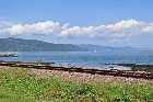
Of course, I had to drive over there to have a good look, and I find myself staring down a steep drop and across a beautiful bay to a small township right over there - a township that I was to identify as St Paul's River - Rivière Saint-Paul.
And as for the tower that you can see on the right-hand side of the photo, this resembles very much one of the LORAN-C nagitational beam towers that are dotted around the Canadian coast - and seeing as we are at the entrance to the Strait of Belle-Isle, it makes sense that there would have been one here.
However, I can't see this post on the list of sites, and so maybe it isn't.

While you sit and admire the view of the bay here, let me tell you that for such a small town - about 470 inhabitants at the last census - it has an astonishing couple of claims to fame.
Firstly, this area used to be right on the frontier of the territories occupied by the Innu (Montagnais) and Inuit (Eskimo) peoples and on one of the islands out there offshore (and I've no idea at all which one it was) is what has been enigmatically described by some as an "important controntation" between the two peoples.
Other people have however placed this "confrontation" elsewhere. Tanner, for example, places it at Eskimo Island at the mouth of the Hamilton Inlet, and yet others at Battle Harbour.

This area was part of the parcel of land handed out by the king of France during the allotments of 1704. The lucky recipient was a certain Amador Godefroy, Sieur de St-Paul who was granted a licence to exploit the fishing, hunting and trading possibilities of the area. He took up the concession two years later.
He was born in Trois-Rivières in 1649 and was captain of the militia of that town during the latter part of the 17th Century and had led a few expeditions against the Iroquois. Presumably, the concession was granted in respect of his military service. Such was the case with many other concessions.
It's not clear whether he made much if his concession - it's known that he remained in Trois Rivières - but it was the Lloyd Brothers, who came here shortly after 1763, who established the first permanent finshing station.
There were still some Inuit in the area at that time and there were several cases of intermarriage between them and those of European descent.
As for the Innu, there were still a good number in the area until the 1960s when they were "relocated" to La Romaine under the extremely controversial "resettlement" programme.
And then, believe it or not, here in the beautiful sunny weather, we suddenly have a rainstorm before we've even gone 150 yards down the road

No such issues in 2014 - we're in the middle of a torrential downpour. But at least you can see the bridge over the rivière Saint Paul at the entrance to the town.
You'll also notice the "STOP" sign, written in French. This is another bone of contention out here. Well over two thirds of the population in the region is Anglophone, with First-Nation speakers making up a good proportion of the remainder. Yet Quebec's crazy Francais first, Francais second and Francais last policy subjects these people to this kind of behaviour.
It's very hard to avoid reaching the conclusion that despite all of the claims (most - although not all - of which are grossly exaggerated) that the Quebecois make about the wicked treatment that they received at the hands of the Anglophones after the Fall of Quebec, they are treating their Anglophone minority much worse than anything that they ever claim to have suffered.
It's a rather sad, if not pathetic state of affairs when a Government adopts a policy like this as a form of collective punishment and to wreak revenge on an ethnic minority in their own homes, and it shows you just how craven the Canadian Government really is when it allows this kind of thing to happen without a single word of reproach.
And I've not even started on the 1927 Border Dispute yet.
No wonder the people of the Forgotten Coast want to leave Quebec and join up with Newfoundland and Labrador. Who can blame them?
But abandoning yet another good rant for a while, let's return to the river. Back in the earliest days of European settlement it was known as Eskimo River after an encampment of Inuit that was out near the mouth.
It's said by some to be "one of the best salmon fishing rivers on the Quebec-Labrador coast" and its rights have been jealously guarded. In 1819 the rights on the river were inherited by one Louis Chevalier, an adopted son of the Lloyd Brothers who were the traders here.
His descendants have clung onto them even until today and tt's surely something of a remarkable feat, given how many fishing rights on rivers out here were acquired by sports clubs out in the city of Quebec and Montreal, and even in the USA.
The presence of the Inuit here can be explained by the fact that the river provides one of the easiest passages into the interior of the country, so this would be a natural route for them to come down to the St Lawrence River to exploit the ocean harvest and to trade with the Innu and the Europeans.

When I was here in 2014 I drove down to the harbour to see what I could see, and the answer to that was "not much". The weather certainly was miserable back then.
But the sheltered bay gives you some idea of how attractive the area must have been to the early settlers. You saw in the photos that I took from the scenic viewpoint just how long the entry to the bay is - it can almost be classed as a fjord - and there are several large islands just offshore that would protect it from the storms out in the Gulf of St Lawrence and the Strait of Belle Isle.

I came back in 2015 to retake the above photograph. The brief storm that I had encountered had passed on and we were back in the blue sky.
The pontoon there indicates that the bay can't be all that deep just here, and in fact all of the 18th and 19th Century fish processing was done on one of the islands offshore - Bonne Espèrance Island. I would have liked to have gone out there to have a good poke around but I was told that there is very little to see today.

There's a population of just over 450 who live here today, and I did say that the place has two claims to fame, one of which I have already mentioned.
The second claim to fame that it has is that it was the home of a certain William Whiteley the third.
He originated from Cambridge in the USA and came here in the 1840s after his mother remarried (Whiteley's father having been murdered) a local man by the name of Buckle, who was one of an important local fishing family and who still has descendants engaged in the fishing industry in the area.
He quickly learnt the fishing business and having received a substantial inheritance from a distant relative, launched the large-scale fishing operation from the village.
And he passed into immortality by inventing the Whiteley cod-trap, a device for catching cod in shallow waters which dramatically increased the amount of cod caught per employee and which was still in use until the collapse of the cod-fishing industry in the 1990s
And one thing that I learnt out here in St Paul's River is that a petoncle is a scallop - at least it is according to the sign on one of those buildings over there in the photo above.

As I said back in 2014 ... "on many occasions" - ed ... if only the weather would improve there would be some really beautiful places along here to photograph.
And while I was stopped just here taking this photograph looking back towards St Paul's River, a car pulled up on the other side of the road and the woman driver asked me if everything was okay. That was really nice of them and just goes to demonstrate the typical friendliness and concern of the people of the Forgotten Coast, doesn't it?
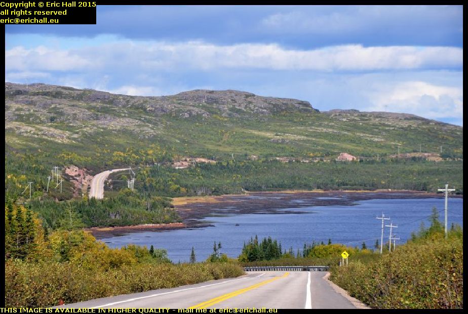
No such complaints about the weather in 2015 though. I found exactly the same spot, which was about 100 metres down the hill to the right by the yellow sign. But the advantage of having the decent weather is that I could see so much more of the scenery and the view was a million times better from higher up the bank.
I was really lucky with the weather today and I couldn't have wished for better. Just for once, fortune was smiling down on me.

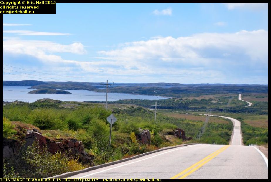
Just a couple of miles outside the town of Old Fort I came across another view that I reckoned would have been really splendid had I had more luck with the weather in 2014.
However, it can't have been as good as I thought it might have been because when I drove past here in 2015 it didn't register with me at all and I must have driven past the viewpoint without even a moment's thought.

From this photograph here you'll see that people in authority DO actually read the notes that I write about my travels around north-east Canada. This that you see in this photograph is something that I've long been advocating.
We've seen ... "and on many occasions too" - ed ... the Highways Authority of Quebec and of Newfoundland and Labrador using galvanised steel culverts to infill gullies and to bridge streams, and we've seen how quickly they rot away and cause the roadway above to collapse.
I've been advocating concrete culverts for years for despite the extra transportation costs, that's just a fraction of the costs of replacement of the steel culverts and the inconvenience that's caused to the users of the road.
And finally it looks as if the authorities are learning the lessons of the perils of cheap construction. These lorries and several of their brothers were awaiting a ferry at Matane to cross to the North Shore of the St Lawrence River when I was there in September 2016.
And another thing that you will notice in the photograph above is how they have constructed the road. They've used selective boring and controlled explosive to cut the road through this outcrop of solid rock.
Mind you, given the temperature variations that they have in this part of the world, I would have been very tempted to try the historic method of freeze-thaw, pouring water down the boreholes and letting the freezing weather crack the rock.
©