 | USA - SEPTEMBER 2002 |
CROSSING INTO UTAH
Leaving Page, I was still in a foul mood. When I stopped for fuel a few miles further on. I asked at the petrol station for a map of the state. The woman there took one look at the car and replied "you don't really need one. Vegas is straight on". Now that p|$$ed me off even more, I can tell you.

So I headed north towards the Utah border, and despite everything, I was glad I came this way. Just a few miles north of Page on Highway 89 I went over a small nondescript rise, and upon arriving at the top, I was greeted by this view on the left.
It looks just so impressive on the photograph and when you see the enlarged version (by clicking on it, of course) it looks even more impressive.

In real life it was absolutely magnificent. I just couldn't describe it. In fact I sat here for 5 minutes drinking the coffee I had just bought at the petrol station just up the road, simply to admire the view.
Well, " you would, wouldn't you?", as the legendary Randy Mice Davies once said. Well, at least one of us would.

A mile or so further on is the Utah State line. I'm really in the wilderness now and totally off the beaten track so a photograph was in order, just to say that I was here. I'm unlikely ever to find myself here again. At least, that was my thought at that particular moment. As I drove further and further into Utah I became more and more determined to return - as I'm sure you will be the more you read of this adventure.
Once over the State line, the highway starts to climb up out of the Glen Canyon area and on to the area know as the Vermillion Cliffs.
The photograph on the left is effectively a "reverse angle" shot of SW2078 from across the valley. It's another one of these views that you don't see until you look in your rear-view mirror, and then you're obliged to do a "U" turn and go back to take the picture.

The next two photographs are of the Vermillion Cliffs, east of Kanab, Utah. This one was taken at mile marker 30.
You can see quite clearly why they are called the "Vermillion Cliffs" from these photos. Just look at the beautiful colours.

This one was taken a couple of miles further north, closer to Kanab, both on Highway 89. I tell you what - Highway 89 was starting to have the same effect on me that Highway 2 in New England did the previous January when I was last over here.
PAHREAH and PARIA

The monument on the left is a monument of the town of Pahreah (or Pareah according to some book I read, or Paria according to my map, so please yourself). As you can see, they had it tough and (I'm not ashamed to say it) serve them right too for squatting on native American territory anyway.
It turns out that the town of Paria is now used as a set for various assorted western movies. I quite fancied the idea of driving down to have a look around. I'd always wanted to be an archaeologist, but I reckoned that it would have meant that my career would have been in ruins. Nerina would have been happy, though. I told her that when she reached 32 years old I was going to trade her in for two 16 year olds. That was why she ran away from home when she was 31. If I had been an archaeologist she wouldn't have needed to have worried. The older she became, the more interesting I would have found her.
Anyway, what with shortage of time and the likelihood of a "toll" (don't let anyone kid you that the USA is the "Land of the Free" - I've come across this sort of thing on other occasions over here in the USA) I pressed on.

Here's a photo to really confuse my friend Lorna - I once told her that the only reason you'd ever find me photographing a flower would be if there were an old car parked on top of it. So, not a car in sight (not even the Mustang). So why take it?
Well, here at the side of the road in the desert there are clumps and clumps of wild sunflower growing. Without any irrigation and without anyone tending them. Now why doesn't anyone set out to farm them? There are enough semi-arid areas in the world where they would appear to be able to be grown, and a simple refinery would enable local areas to have their own fuel supply.
Ahh yes - I forgot. That will explain it. This would mean an independence from fossil fuel supplies controlled by the "seven sisters". Better hadn't push this point in case I get put in a concrete overcoat and become a vital support in the USA's new transport infrastructure! Discretion!

The following three photographs were taken just north of Kanab, still on Highway 89, in a canyon whose name I never ever did discover. This is another case that a photograph can never do justice to a real landscape.
It was quite welcome to come across a watercourse out here, that's for sure.

The travel book I read suggested that I don't go this way but take another route. but this view in real life was so spectacular that I did a U-turn at 70 mph and went back to photograph the landscape. I wonder how beautiful this other road must be?
I mean - surely the route they wanted me to take can't be any more beautiful than this?

"But wait a minute, Eric. I don't understand. You with a travel book?"
"Yes, but I read a travel book when I return home, to tell me where I've been, not to where I'm going!"
Half (if not more) of the fun when you're driving around without a guidebook is that you never know where you end up, and seeing as I never know where I am at the best of times, well I have years of experience at this! Who needs a guidebook anyway? Half the fun of going anywhere is that you might well encounter the unexpected.
GLENDALE
A few miles north of here is the small town of Glendale - still on Highway 89. This town was first settled by a party of settlers, led by a family named Berry, in 1862. The local native Americans played a famous April Fool's joke on the settlers in 1866 by killing several of them, and as a consequence the town was abandoned.
In 1871 it was resettled and renamed Glendale - either due to the magnificent surroundings or because this area reminded the priest of his home in Scotland, depending upon who you talk to. My vote goes for the first explanation - not because I agree with it, but because there is absolutely no way that this area looks anything like anywhere in Scotland that I've ever been to.
Now, many of you are probably wondering why there haven't there been so many photographs of old cars just recently. I mean, on any website I'm involved with you would ordinarily expect to see old cars everywhere, like when I was in Ellsworth, Maine, back at the turn of the year. Well, the truth of the matter is that there were so many of them around here that I'd be still there (what a good idea!) photographing them if I took pictures of every one I saw. There's something old and interesting in almost every garden.
It was really just a case of excercising patience until I found something really exceptional to make it worth stopping to photograph. Something rather like here in Glendale, Utah, in fact.
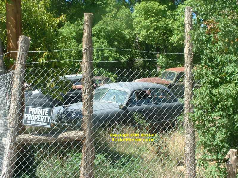
Yes - for those of you suffering "old car withdrawal symptoms", here's a few old cars to keep you entertained.
You can see that Glendale does in fact have something going for it after all. And it has it in spades as well, as you can see.

What do you have to say about all of this?
I did a quick count and I reckon there are about one hundred or so cars parked up here in this compound, and they are all priced up and all for sale. In fact, some of them even have the road test information in the window, together with a notice to the effect that if you aren't sure of anything, ring the phone number on the door.

I made a note of the telephone number for my own personal reasons and if you say the magic words, I can let you have it too.
"Oh stop messing about, Eric. You'll get a good price for that number"
"Ahh - so you know the magic words then."

You have to admit that all of this is really superb. I'm glad I came this way. What on earth was that guide book talking about, recommending another route that bypasses here?

By the way, you can keep your eyes off the van (or panel truck) in the foreground in the photograph here on the left. It's spoken for and once I organise my luggage allowance it's coming home with me. After all, I saw it first! Can I fit a 2.5 NA Transit diesel motor into it? I know just where there's one of those lying around.
And you can forget about the blue pickup as well. I think Paul has his eye on that, so that's something else I'll have to smuggle onto the aeroplane in my hand luggage. I can see this voyage turning into a nightmare of logistics difficulties. If only I was in a truck....
Now, back in the dim, distant dawn of time, I'd read somewhere that there was a part of the State of Utah that had been so rough and difficult to traverse that it wasn't until the 1940s that they'd been able to build a road over it. With a lead-in like that, you don't really have much option. Where is it again?
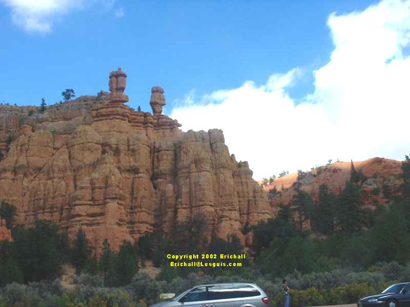
RED CANYON
It involves going north from Glendale up Highway 89 until you see "Red Canyon", then turning right eastwards onto Highway 12 and heading for Escalante. Ahh yes. That turning is just here.

Now isn't this all quite spectacular too? I'll say! Just look at some of these outcrops and weird erosion effects. And you can certainly see why this is called "Red Canyon".
I'd bought myself a sandwich at the "Subway" in a petrol station in Kanab way back down the road. This looked like just the place to stop and eat it. And to admire the view at the same time. What a good idea

Now in the photograph on the right you can see a cycle track. What you can't see, however, are any cyclists. This is possibly not unconnected to the sign at the visitor centre down the road that warns pedestrians of the danger of bears in the vicinity. I suppose that coming down here on a bike then is the equivalent of providing a "meals on wheels" service for the local bear population.

This reminds me of when I was in Slovakia. I wanted to go skiing off-piste in the High Tatras, soI was warned by the guide to make sure I only took the bare (or was it "bear?") essentials with me.
It also reminds me of another time when I was in Canada in 2003 when a tourist was overheard to ask his guide
"Is it true that a bear won't attack you if you carry some garlic in your pocket?"
to which the guide replied
"it all depends how quickly you can carry it".
A sign just here to the right indicated to "Bryce Canyon". This was once described as a "hell of a place to lose a cow". This is said to be one of the most spectacular corners of Utah, but just how much time was I supposed to have? The decision was taken out of my hands when I saw the sign "admission fee". I drove straight past. Like I said - "Land of the Free"? You must be joking.

Well, no I didn't really drive straight past, I did in fact stop. But this was because I had a phone call to make to Marianne in Belgium, and there was a telephone box handy. Now, imagine a view like this on leaving a telephone box in a neighbourhood near you.
The mountain over there in the distance, which seems to resemble what we as kids would call the Big Cock Randy Mountains (which most Americans won't understand) is known as the Painted Canyon, for reasons that you will see. But one thing has to be said - the rocks around here were a geologist's (and a painter's) dream.
This made me immediately think of that weird guy called Randy Paynter, or Randy Painter, or whatever he calls himself, which is something else most Americans won't understand. I talk about that elsewhere too.
Next stop from here was Escalante. This involved quite a nice 40-mile thrash along the old road up the Escalante Mountains into the town itself, and the Muzzy took it well. For some of the way I was stuck behind a school bus with a load of kids in it. They were all pointing and waving (with all fingers, not just one - American or two British either), so at a suitable place, I dropped a couple of cogs and roared past them, to give them some entertainment. And why not? I love kids. I used to go to school with them.

Arriving at the top of the hill just outside Escalante, I was greeted with this absolutely splendid view that you can see just here, right across the valley to Boulder.
It was from this point onwards that they had had to wait so long for the new road to be built. This indicated to me that this next part of the route was going to be extremely interesting, to say the least. This was going to keep me fully occupied for the next few hours, I'm sure. You only have to look in this photograph and what you can see in the distance will let you work that one out.
But as an aside, there was still the time and chance of doing something else before I reached the interesting part.
THE HOLE IN THE ROCK TRAIL

This is the start of the "Hole in the Rock" trail that leads down to the Colorado River, some 40 miles away. It's part of the area's Mormon heritage. The Mormons, fleeing the religious persecution of the mid 19th Century, were called in the late 1870s to settle the San Juan river valley. So they carved their own trail out out of the desert - even cutting a hole in the side of the mountain to pass their wagons through. The journey was supposed to take 6 weeks. It actually took 6 months! That must have been some journey, unless the people who built the trail were local council workmen.
I drove down here for a few miles (in the Mustang!) but after a while I began to realise that I was heading into a real wilderness and that a 40 mile journey (80-mile round trip) can easily take a whole day - if I'm lucky. And being low on fuel, with no accomodation organised, working to a fairly tight schedule, and without knowing exactly what's awaiting me down the road, I turned back.
Anyway, on with the plot. Between Escalante and Boulder, it's maybe 20 miles. No more, and probably a little less. Yet it took me over 2 hours to drive it. Like I said before, there was no highway here until the very early 40's. Everything had to come up here by mule. However that doesn't explain the time it took me to drive this distance.
©