 | CANADA |
PESSAMIT AND RAGUENEAU
If you want to see how Highway 138 must have been until - well - comparatively recently I suppose, there's a section called the Chemin au Pierre, round about marker 685. This section of the road is only 2.5 kilometres long but it's well-worth taking provided that you pay attention while you are driving down there.
It's maybe not so advisable to take this road in the wet or in bad weather conditions, I imagine, but I'm lucky. It's a glorious day today and it's quite dry However there is dust everywhere.
And back on Highway 138 again there's a lorry just gone the other way and I notice that it's a CAT - that isn made by Caterpillar. Now is it an old one or has Caterpillar started to make lorries again?
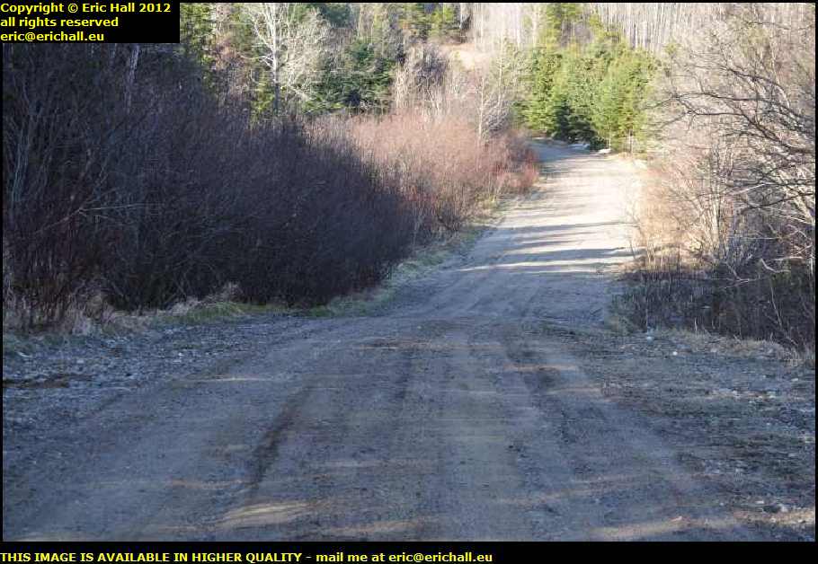
Just after here I'm stuck in roadworks again and this gives me an opportunity to look around.
When I was up in Labrador in 2010 I noticed that many of the streams and rivers had been culverted by these corrugated, galvanised tubes, and the road laid over the tubes. I remember saying that I didn't think much about their longevity.
I could understand them doing it though, because the logisitics of trucking concrete sectional culverts up there must be difficult, but I could never understand why they used these corrugated, galvanised tubes in areas where they didn't have the same transport difficulties.
And sure enough, these roadworks are all about digging out a rotten tube that has collapsed, and replacing it with another.
The queue isn't about the roadworks though, as there is something of a route du fortune at the side for vehicles to pass by, but there has been a major accident just here, with police, firemen and the ambulance service in attendance.
I was going to photograph the roadworks but it was not in good taste to do it while there was everything else going on.
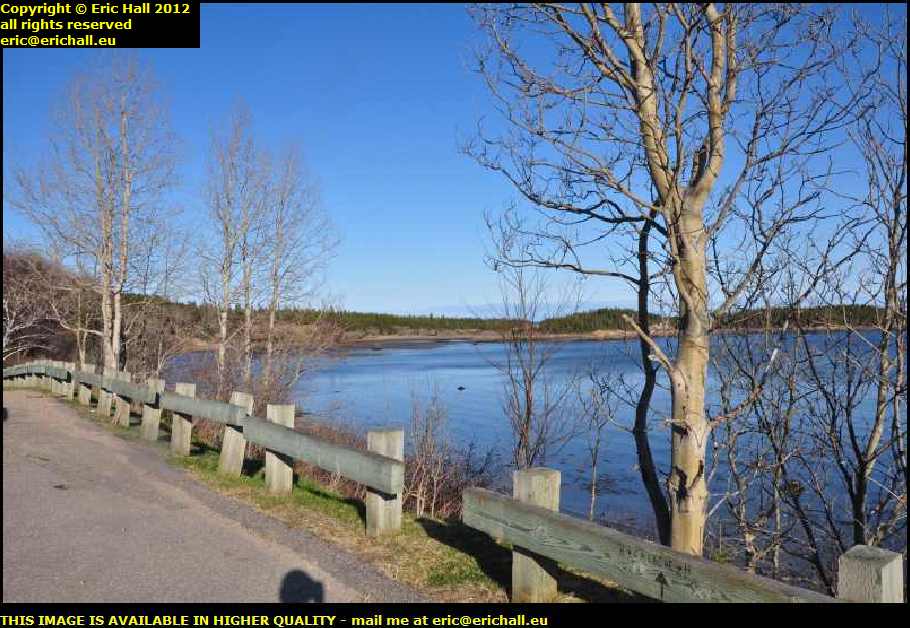
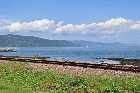
A little futher along the road is a nice little place to stop (with everything that I drink as I'm driving, I have to make frequent stops along the road).
There's a little bay just here and with the beautiful blue sky that we had back then that late afternoon in May 2012 it made a good photograph.
Now is perhaps a good time to mention two things about the scenery along here
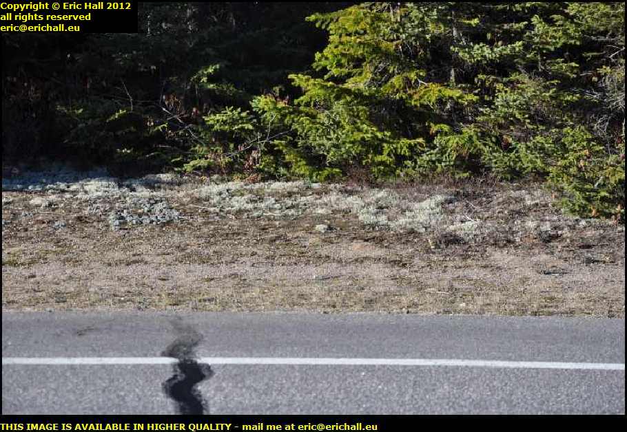
As I approach the town of Betsiamites, I'm starting to encounter lichen growing at the side of the road.
Generalisation is of course quite easy, but this does quite often indicate the start of a descent of climatic conditions towards the sub-Arctic, although you might not think so by looking at the weather today.
You will notice that the fertile soil that we saw a couple of hours ago is no longer present. What we have here seems to be nothing but sand.
The sand, by the way, comes from the action of glaciers back in the Ice Age. Boulders are picked up by the advancing glaciers and they are rubbed together, the sand being the debris that results.
Just along here is a sign with the image of a cyclist thereupon and with the legend partageons la route, or "let's share the road".
Personally, I cannot think of anywhere where you would be least likely to find a cyclist, except maybe on the Trans-Labrador Highway . We are miles from anywhere around here and with the hills and valleys and cliffs and so on along here, much of the route is up hill and down dale.
The only reason that I can think of that might require the presence of cyclists along here would be some kind of "Meals on Wheels" service for the local bears.
That did rather remind me of the story about the tenderfoot talking to his First-Nation Canadian guide out here many, many years ago
"Is it true that if you carry a piece of cheese with you in your pocket, you won't be troubled by bears?" asked the tenderfoot.
"It all depends how quickly you carry it" replied the guide.
When I was down here in October 2010 close to the River Betsiamites I noticed that they seemed to be putting a second carriageway along Highway 138 just here.
I couldn't think for the life of me why they would be wanting to do something like that just here because there's hardly anything on it. It's been a while since I've seen another vehicle so it just made no sense to me at all.
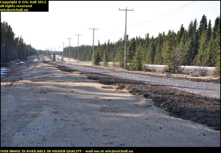
18 months or so later, in early May 2012 I passed by here again and as whetever they were doing seemed to be finished, I stopped to have a closer look.
What they seemed to have done is to simply lay some kind of gravel track or path at the side of the existing road. And this gravel track or path deosn't even seem to be tamped down either - it's just loose gravel.
So basically I've no idea what they've been up to and what this is supposed to be, unless it's perhaps a track for snowmobiles in winter.
Next stop, according to The Lady Who Lives In The SatNav, is a town called Betsiamites. There's no trace of that anywhere, but instead I find a town called Pessamit.
They are quite clearly one and the same, and the change of name is no surprise because many places that have formerly been known by an Europeanised pronunciation of their names are now reverting to their original First-Nation pronunciation, and Pessamit is the home of an Innu community, founded in 1861.
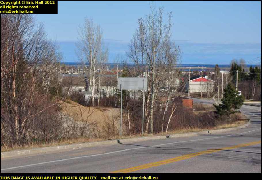
I took a trip down through the town to see what I could see, and apart from the spectacular view of the St Lawrence in the background, its all very much small white cabins and very small houses, all of which are on very compact plots. It's the home for about 3,500 people.
A police car drove past me while I was looking around, and took a very great interest in what I was doing. The car was not white like police cars that I have seen in the rest of Canada but it's black. Does this mean something of significance?
Our Route des Baleines seems to have changed its name around here too, and it's now known as the Route Jacques Cartier.
It's a fact that many places the whole world over are named after the person who made the discovery. I wonder what Cartier said to his shipmates when he discovered this road.
I've been making reference to the mile-markers - or maybe I should be correct in saying "kilometre-markers" - along the road here as being the best indication of telling you where I am at any given moment.
And as I pass a marker for 714 kms, I ask myself the obvious question - "714 kms from where?". If it's going to be from a city, it would be from the city of Quebec, the capital of the Province, but it's not. Thats just 300-odd kms away.
So maybe it's from the start of the road down at the Quebec border with the USA.
Where I am now is at the beach in a sheltered bay, right close to the town of Ragueneau. And while you look at the photos and admire the view, I'll tell you a little about the history of the area.
Before the roads arrived here in the 1940s and 1950s there were a couple of important ferry routes from Rimouski and Matane, coast-hopper services that ran to many of the settlements along here.
Places such as Sept Iles, Clarke City, Shelter Bay, all the way along the coast up there, down to Baie Comeau, Ragueneau and Pessimit were served by the ferries, which called here twice each week.
People wanting to travel out of their immediate neighbourhood had first to go on the ferry that zig-zagged its way up the coast before finally corssing over to either Rimouski or Matane, because those towns were where the railway line was.
All of this came to an end with the arrival of the roads, and in the 1950s the facilities at Ragueneau fell into disuse.

This story does remind me of another little tale that I heard many years ago. It concerns the new Member of Parliament for the constituency of the islands of Orkney and Shetland, elected to represent the inhabitants of those island at the British House of Commons.
Travelling expenses back in those days (when Britain had a rail network) were calculated on the basis of rail fares,and so one of the questions on the form that MPs had to complete was "which is your nearest railway station and which company provides the service?".
The new MP replied, quite truthfully as it happens (and if you don't believe me, measure it yourself), "Bergen, and Norwegian State Railways".
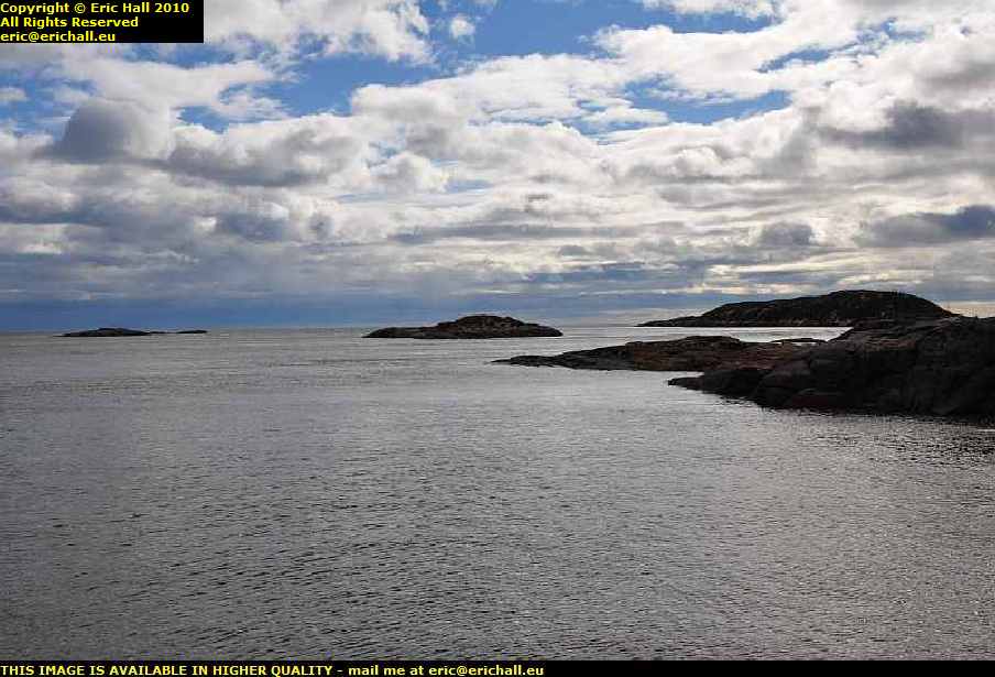
There are dozens of these little islands dotted about offshore and in the bay
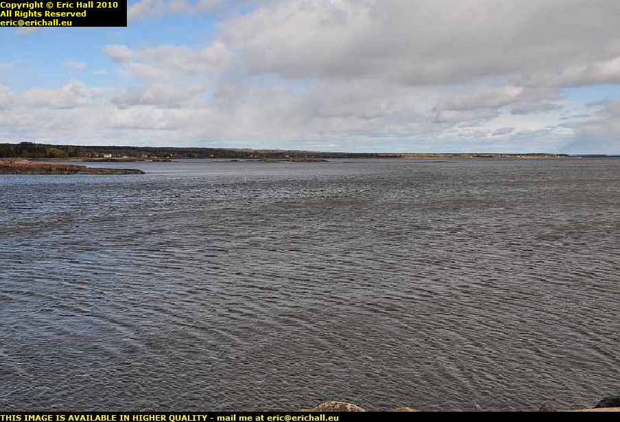
There's also quite a current in the St Lawrence River, and also some very strong winds that can suddenly spring up out of nowhere, one of which I told you about back at Deschambault a good few days ago
We also have the sudden rolling fogs, the kind of which was instrumental in the sinking of the Empress of Ireland across near the southern shore.
What with all of this combined, this area must have been a matelot's nightmare, being really difficult to manoeuvre your way around here back in the days of sail.
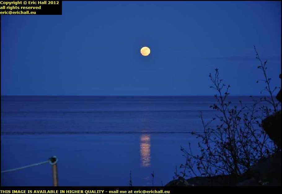
But when I arrived here at Ragueneau in May 2012 it was already the early evening and having noted in 2010 that this little spot down here was quite calm and peaceful, I decided that my overnight stop would be here, with the view over the sea and with the full moon for company.
For those of you who aren't aware of the situation, I'm travelling in a Dodge Grand Caravan with just the two front seats installed. Behind me is a child's simple bed (not a simple child's bed) cut down to a width of 70 cms, a camping stove and a couple of storage boxes full of this and that.
What they call "self-contained".
©