
|
CHEMIN DU ROY |
|
|
CHEMIN DU ROY |
PORTNEUF
When I came here in April 2012 I drove right past Portneuf without stopping because it was evening and I was preoccupied with searching for a place to stay for the night. And having found one, I simply forgot to come back to town next morning for a look around.
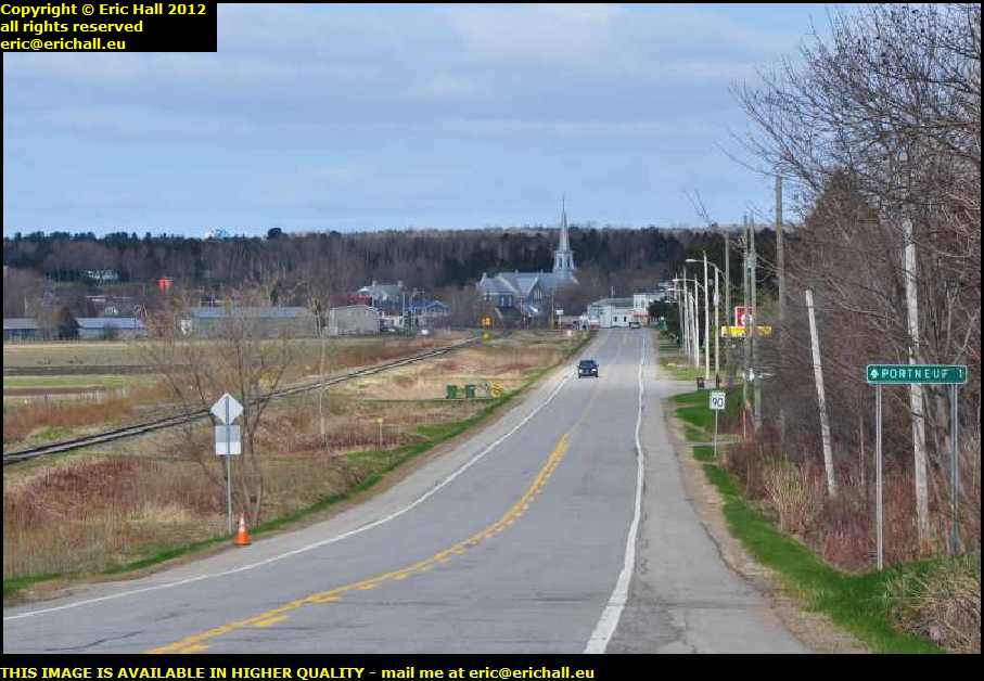
However, as I have said before, the purpose of my journey in September 2013 was to catch up on the places that I missed in 2012, and so here I am again at Portneuf
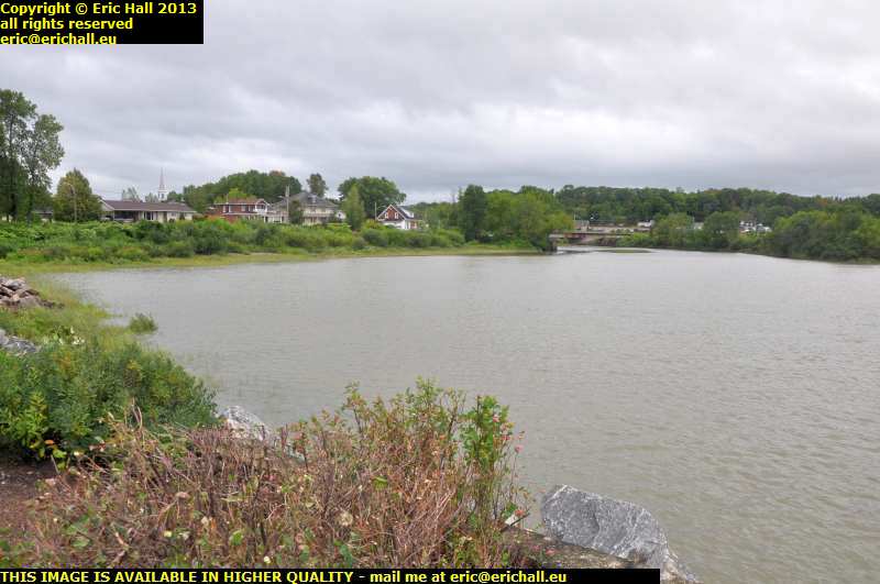
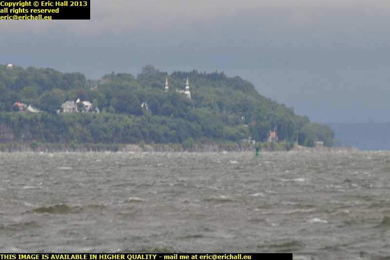
But while we're looking at this photo, you may remember all along this journey we have been discussing the wide flood plain of the St Lawrence and the high banks at the extremity of the plain. When we were out near St Bathélemy we were looking at banks of about 30 feet in height.
Here at Portneuf, however, how high do you reckon that the bank is behind the town? Of course, it's difficult to tell, with the trees just there, but it must be at least double that height. The power of the water is certainly impressive.
So here we are in 2013 of course, and a couple of kilometres further on from the Moulin de Chevrotières we turn off the modern Highway 138 to follow the old Chemin du Roy into the town
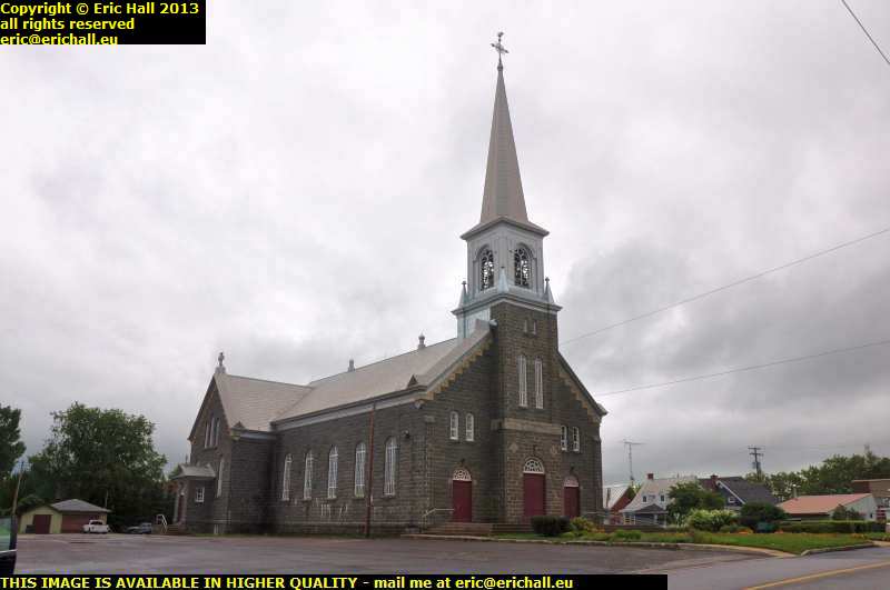
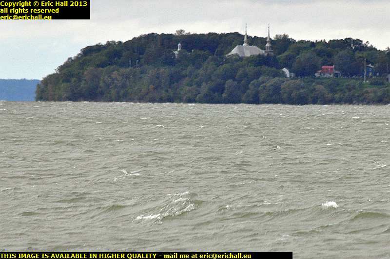
As you know, in case of any doubt, always head for the church, which in our case is the Church of Our Lady of the Seven Sorrows, the Notre-Dame-des-Sept-Douleurs. The church is usually (although not always) the centre of the town and it's a good enough place to start.
And as for the church, it is noteworthy in that not a single word is written about it in any of the more usual tourist resources of the Province. In such a markedly-Catholic region such as the Province of Quebec, that is indeed noteworthy.
However, I can understand why. If Pevsner had written about important buildings in Canada, he would have described the church as "of little if any merit", and unfortunately, I would be obliged to agree.
Now here's a thing.
I was about to park up quietly in the Municipal Car Park here and tell you all about the town but my attention has been completely distracted.
Some of you may remember back in November 2010 as I was climbing up Cap Tourmente on my way back to the city of Quebec from Baie St Paul, when I was overtaken by a big black hefty-looking pickup travelling at a rather rapid rate of knots.
Being me, and having had the encounters that I have had, I was quick to notice the array of radio aerials and discreet coloured lights and I remembered saying to myself that the vehicle looked suspicious. And sure enough, a few miles further on, it was there at the side of the road, with another vehicle right behind it, and there were two policemen having a frank and earnest discussion with the driver of the second vehicle.
Voiture banalisée I thought to myself in my best French. Unmarked police vehicle on speed radar duty
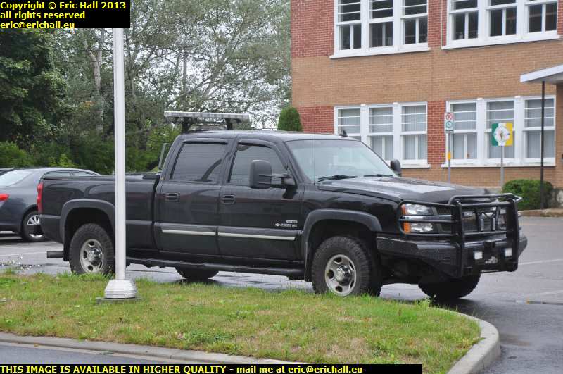
However as time passed, I began to wonder whether it had all been a figment of my imagination, but what do I find parked up here on the car park outside the Edifice Municipale?
Yes, if it's not the very vehicle that I saw, it's one that's very much like it.
Just then, someone came out of the building and on the basis of "if you want an answer, you need to ask the question;", I went over to find out what he knew about it. And with truth being much stranger than fiction, as we all know, it's apparently this person's son who is the driver of it.
Son is said to be the Chief of the local Fire Brigade, and this is a Fire Brigade vehicle used for emergencies on the highway and that kind of thing. Firemen here are very much more than British firemen, rather like the Pompiers in rural France who are also paramedics, ambulancemen, Civil Defence volunteers and so on, so maybe this isn't an police vehicle at all.
However I did notice that the peson I was speaking to was very uncomfortable in replying and was clearly hedging my question, so maybe even if this particular one isn't an unmarked police car, the Quebec Police Farce does have a few.
I shall have to keep on looking.
As for the town itself, there was nothing that particularly caught my attention. It had been something of an important industrial centre, due, I imagine, to its proximity to the deep-water channel of the St Lawrence and the fast-flowing Riviere Portneuf that would have provided water power for machinery. However, I couldn't see much that remained.
Today, it's a quiet backwater of about 3,000 inhabitants.
When Cartier arrived here though, it was the site of a Huron village which he named Achelay. With the arrival of the white man, the natives didn't last long and upon its settlement by Europeans in the 17th Century, the new inhabitants called it simply "Port", which is hardly surprising, as you will find out in a minute or two.
The land was later allocated to the Sieur de Neuf and like any respectable nobleman back in those days, he made sure that his name was added to the name of the settlement.
Our interest in the town is that it was another one of these 29 (or 30, depending upon how you count them) towns that was a staging post on the Chemin du Roy, the route of which we are following.
All of the excitement takes place today down at the water's edge and so we need to take ourselves off to there, despite the howling and bitter wind.
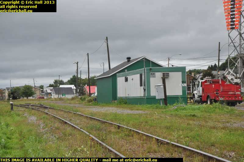
The road down to there takes us past the old railway line, and this looks very much like the site of a railway station to me. I've never seen a train on this line (which is, of course, not to say that there aren't any but the state of the tracks doesn't look encouraging) but there is another railway line about three or four miles inland, where the town's more recent railway station is situated. I'll have to go for a look at that.
But before we leave here, have a look at the upper right-hand corner of the image. Do you see the orange and black signing there? It took me a while to work out that it might be, and then I noticed another one on a prominent eminence a little further inland. Lining those two up would put me, if I were in the St Lawrence, in a perfect line to enter the town's harbour.
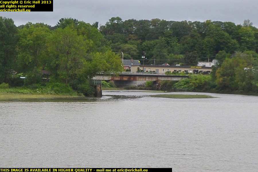
I spoke a short while ago about the town's industrial heritage, and I mentioned the Riviere Portneuf that flows through the town and enters the St Lawrence here.
If you look underneath the modern road bridge that carries the present-day Highway 138 past the town, you'll see the river back there, with the modern part of the town of Portneuf in the background.
With having a decent high-quality lens, I can crop something out of the former image and show you a better view of the Quai Lemay.
That's the old harbour for the town of Portneuf and it is where the Goelettes, the sailing boats that plied their trade up and down the shore of the St Lawrence, would tie up when visiting the town.
Of course, the Goelettes are long gone now, and the one that we encoutered at Baie St Paul was very sad indeed.
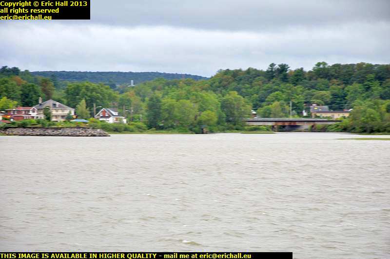
Here's a better view of the Quai Lemay and Riviere Portneuf where it enters the St Lawrence, and the old mooring facilities are a little easier to see from here.
But I'll have to come back in the Spring I reckon and retake this photo. You can't see anything at all with all of the leaves on the trees and it can hardly be any colder in April as it is right now. I'm freezing to death and it's early September.
And so, you say to yourself, "is he in a boat or something, taking these photos so far off the shore?"
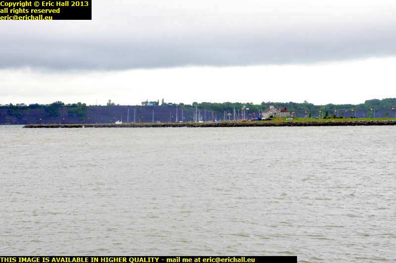
The answer is that I'm not, because in 1958, a new quay was built that stretches out over a kilometre right into the deepwater channel so that even large ships can moor at the town (not that they ever do because there is no heavy lifting gear here and there's certainly no rail link to the line that we crossed on the way here.)
Today it seems to be mostly for pleasure purposes (you can see the marina just up there - I'm only half-way along the pier here) and, so we are told, "so that people can relax themselves by looking at both banks of river;"
But who could possible want to relax on here today. As I told you earlier today, Montreal was bashed by a hurricane last night and it's now caught up with me as I'm walking along the pier. Just look at these waves!
In the background is Cap Sante, the "Cape of Good Health", and we'll be there tomorrow for a good look around.
Always, of course, assuming that I'm not blown into the river. It is thoroughly wicked here right now.
Here on the lee side of the pier it's not quite so bad, and we can have a good view of "Cap Lauzon" and the town of Deschambault, where we were a little earlier today.
From this point of view you'll immediately see why Murray wanted to built a fortified position at Deschambault once the area had been taken into possession by the British. It's a magnificent situation for dominating the St Lawrence and the approaches to Montreal, and scaling the heights to overwhelm the defences would take a great deal of thought and energy.
Not only that, there's only one real meander in the whole of the St Lawrence and it curves round a headland, the Pointe au Platon, on the south shore.
Sailing ships, with the rigging set to sail a north-west course to round the headland, would present a broadside full on to any cannon on "Cap Lauzon", and would risk becalming as the rigging of the ship would have to be switched over so that the ship could tack to the south-west to continue its journey. A perfect stationary target.
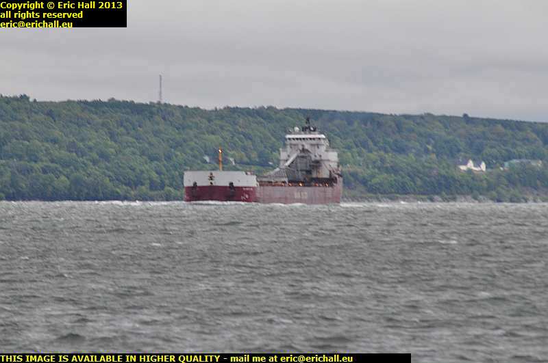
And right on cue, the Atlantic Erie gives us a perfect demonstration of exactly what I mean.
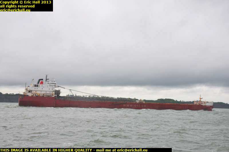
Here's a better view of the Atlantic Erie as she goes past us here on the end of the Portneuf Pier on her way to Montreal from Stephenville in Newfoundland, a town that we visited in 2010 .
She was built in 1984 by Collingwood's yard in Ontario and at the time was the largest vessel that they had built, 255 metres long and grossing 24,000 tonnes. Formerly of the Canada Steamship Lines (you can see that the website address, one of the largest in the world when it was painted on her side in 1998, is now painted out), she's now run by a company called V.Ships Canada, Inc.
When I passed by here in April 2012, the day was fading away into the gathering gloom of dusk - "have you been been at the battery acid again?" ...ed - and I was thinking that I ought to be doing something about an overnight stop. Usually, fate has a habit of intervening and not a mile past the town, something did indeed present itself.
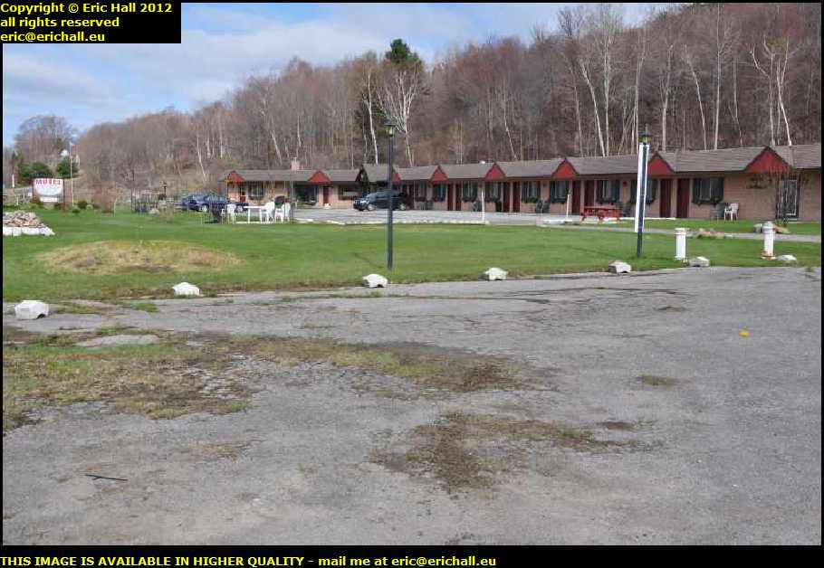
This is the Motel Sous Les Charmilles just outside Portneuf. It was displaying a sign advertising "Winter Rates" and that seemed like a good place to start. After some friendly discussion we agreed on $60 all in for a room and that was that. To paraphrase Mae West, if it's $60 all in, why wrestle with your conscience?
It was well-worth the money too. I was quite impressed. I've paid much more than $60 to stay in many worse places than here and so the verdict is that I'll be here again if similar circumstances arise.
Breakfast was a "help-yourself" affair in the back room. Not very elaborate but then again this isn't the Hilton and, of course, we aren't paying Hilton prices either. We are discussing "value for money" and I've certainly had more than my money's worth.
I had convivial company too - another woman who was staying the night and then moving on. The news was on the television and so we discussed the state of the world. I've made a conscious decision, by the way, to have at least two meaningful conversations every day while I'm here. This should bring me out of my Splendid Isolation.
So enough of my meandering. It's time to go. But although the weather has brightened up considerably and there are no snow clouds today, my very first impression on that April morning in 2012 as I went out to the Dodge was of this absolutely bitter, biting wind. It's going right through me and I've never been as uncomfortable as this. The first positive action therefore has been to rummage through the suitcase to find the woolly hat - my tuque - to go on my woolly head.
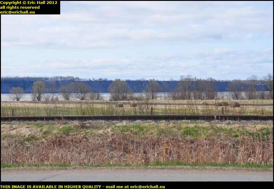
Talking of flooding around here, you can see how high the builders of the railway line have built the embankment along here for their track. They must clearly have been worried about the line being flooded or washed out
In the background, you can see the far, or southern bank of the river. What you will notice about this is that there is no flood plain there, but a long line of low cliffs. You may remember my other theory about the flood plain on the north bank of the river - that it isn't actually a flood plain at all but the old bed of the river as the river slowly changes its course further to the south. This seems to be what is happening here, given the erosion of the cliffs over there.
By the way, that over there is the Pointe au Platon - the only meander of the St Lawrence downstream from Montreal.
I was listening to Physical Graffiti at this particular moment and I made a note on the dictaphone to recall what Led Zeppelin said at a time like this that would be quite apposite. I wish I had noted the lyrics to which I was referring - I would have presented them here for your edification.
But never mind. We're back on the road again.
©