|
THE ILE D'ORLEANS |
|
|
THE ILE D'ORLEANS |
THE SOUTH SHORE
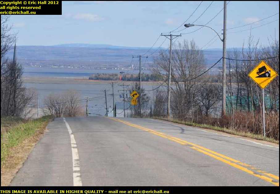
At the eastern end of the island we leave the North Shore behind us on the previous page and turn to the south, where we go over a slight rise. There in front of us is a splendid view of the Ile Madame and the southern shore of the St Lawrence, and so I pulled up smartly on the side of the road to take a photo, much to the consternation of a couple of motorists right behine me.
Pretty as this view might be, it looks quite banal and mundane when you compare it with the north bank. The southern shore doesn't seem to have the same rugged grandeur of the northern shore, and you would probably need to be someone of a completely different character to want to live on the north shore.
This part of the island is known as St François and takes its name from a certain François Berthelot, who was awarded this land in 1679.
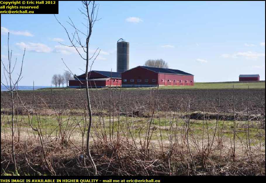
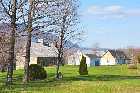
Here's a typical set of farm buildings at St François. You can see that in contrast to whatever might be happening in European agriculture, there's some money around in North American farming to enable them to have some really nice and neat buildings here. It's quite a contrast to Europe.
This part of the island is noted for potatoes, despite the corn hopper in the background. We've seen vines - or, at least, a vinyard or two - elsewhere on the island, and I've also been noticing a few maple syrup plantations and quite a few apple orchards.
One of the things that I've been doing on my travels around Québec is taking photographs of words and phrases that are not found in the français de Paris, and in the service stations that I have seen along the roadside, they don't have mécaniciens but they have mécaniques.

Leaving St François I noted a sign advertising a mécanique général and so I stopped to take a photo of it for my collection.
But pride comes before a fall as they say, because my French friend Marianne tells me that this is a correct term used in France to describe the profession, rather than the guy carrying out the task, and she took me out to St Hilaire on one of our travels where there is indeed such a sign swinging away outside someone's workshop.
Yes, I'll have to scrub this from the list and go back to take a photo of a méchanique sur place - there are plenty of them.
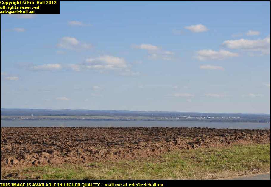
The road goes up over a slight eminence where there is another excellent view across the St Lawrence to the southern shore in the beautiful weather that we are having today.
There's also an excellent view of the soil and you can see why this island is famous for its agriculture. There's another thing too that I will remember about this island and that is that right along the southern shore there was a most overpowering smell of silage. Either that or I shall have to change my socks this evening.
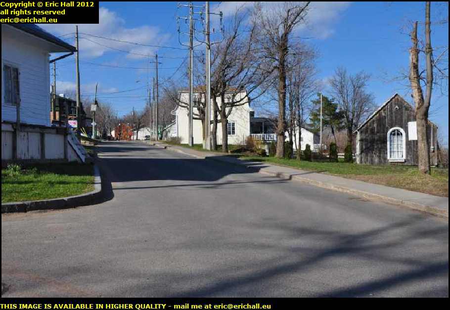
Here's a little admission - I came into a small town somewhere along the coast and I was so captivated by it and so busy was I taking photos of the place that I forgot to make a note of the name of the place.
It's about 12 kms before the town of St Laurent and so according to my calculations it may well be the town of St Jean, with its population of 986 at the last census. That's what I shall be assuming anyway but if you know differently, please and let me know.
Anyway, assuming that this is St Jean, you can see why it's so attractive around here, even if we are being overwhelmed by silage at the moment. This is the view looking westwards towards St Laurent and it really is quite picturesque.
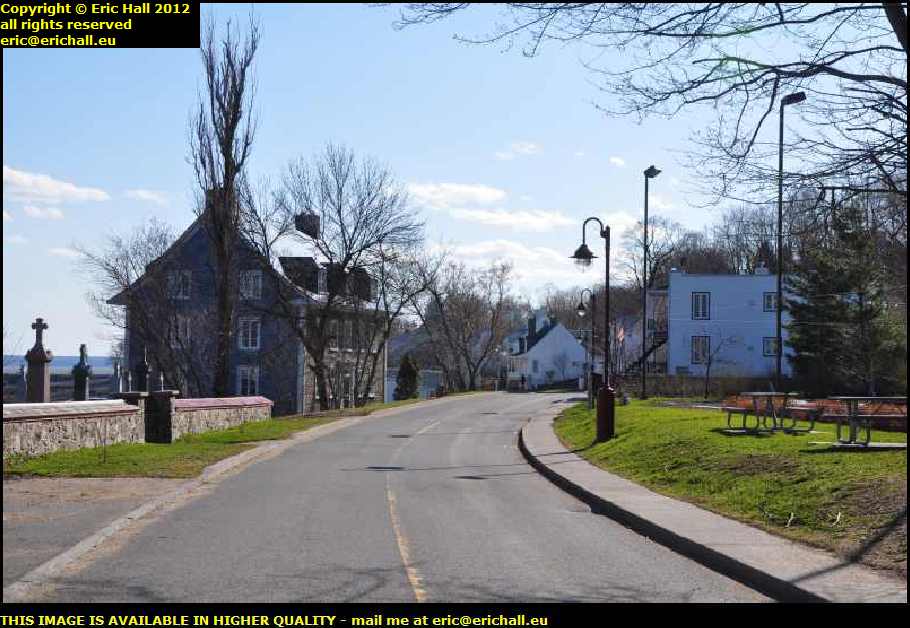
That stone house there on the left is thoroughly magnificent - it's as good as any of the best that you will see around my area of rural France and the view over the St Lawrence must be quite spectacular. It's the kind of home that would be built for someone of real importance on the island.
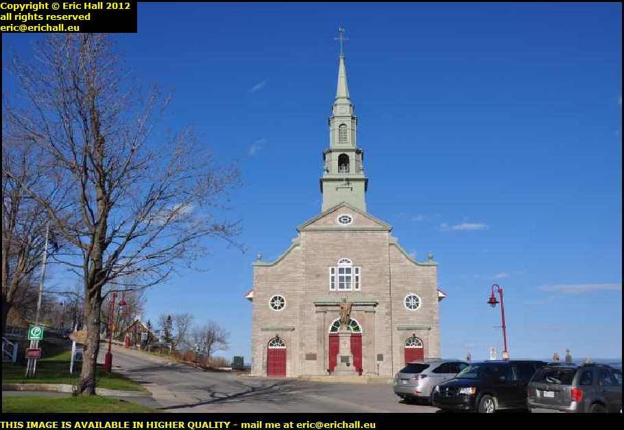
This is the parish church and if we are indeed in St Jean, one imagines that it is dedicated to the aforementioned saint. The church was built between 1732 and 1734 and, strangely for Québec, isn't one of the twin-tower design of church that you see all over the province. Despite that, however, it's classed as a historic monument.
The cemetery around it is worth a wander too. Many of the crosses are quite imposing and that gives you some idea of the wealth of the place and its inhabitants. This was a thriving town back then, what with its agriculture and its seagoing connections. In fact many of the tombstones bear witness to the power of the river, although I did not see a tombstone, as I did somewhere on Cape Breton Island in 2010, of a grave of someone who was "lost at sea".
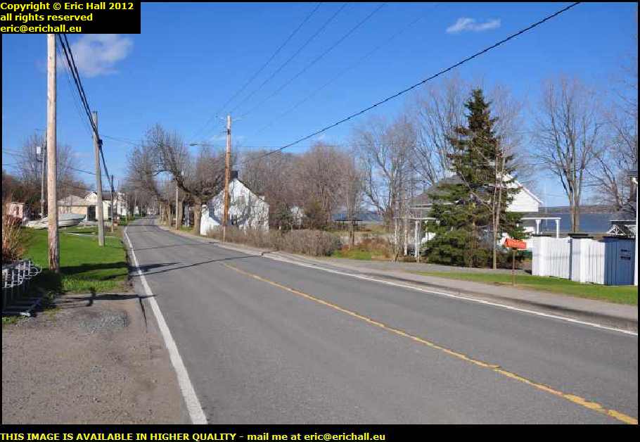
Continuing our westward tour of the island, another thing that we notice, apart from the silage, is that the whole of the south-western shore is covered with these little cabins and houses. Whether they are holiday homes or whether they are full-time accommodation I really do not know but there are dozens of them around here.
One thing that I don't quite understand though is that although the view from here is quite spectacular and would be a wonderful thing to wake up to in the morning, it's nothing like as impressive as the view from the north shore of the island and there seems to be nothing much in the way of this kind of accommodation over there.
Bizarre.
Almost down at the western end of the island the main road turns to the right to head back to our bridge but the small road straight on, signposted to Saint Petronille, goes over a rise and that has to be worth an inspection.
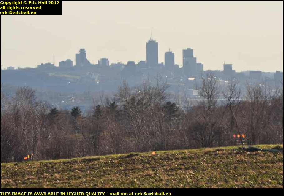
I was right too. There's an excellent view of the city of Québec from up here and despite the mid-afternoon sun shining directly into the camera lens, it's one of those photos that you just have to take.
Another thing that I've noticed about the island is that around the coast at least there doesn't seem to be too much in the way of woodland, except at the eastern and western extremities. Maybe it's because the early settlers cleared away whatever woodland that there was in order to use it for building and heating purposes, and the cleared land was too valuable for agriculture for the inhabitants to replant any.
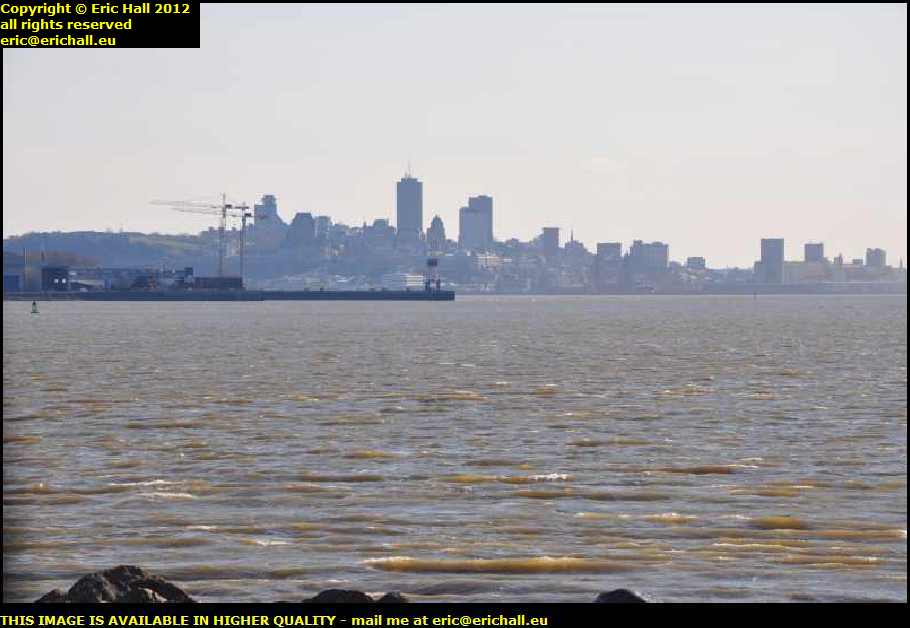
St Petronelle is situated right down at the western extremity of the island with a commanding view across to Québec. This therefore explains two things -
Firstly ... why it is the most popular (and therefore probably the most expensive) part of the island
Secondly ... why General Wolfe chose it as his base for the seige of Québec in 1759
Although the present village was founded in 1870, it was in fact the site of the first colony on the island back in 1649 and prior to receiving its present name in 1870, it has been known by many others, including l'Anse au Fort, Bout d'Ile (by which it is known by many of the inhabitants even today), and Village Beaulieu.
Prior to the construction of the bridge, there was a steam ferry that ran from here to Québec and I bet that the sailors on the ship knew this place by a few other names too, that I shan't record here, as they tried to manoeuvre the boat into the harbour with a running tide and a westerly wind.
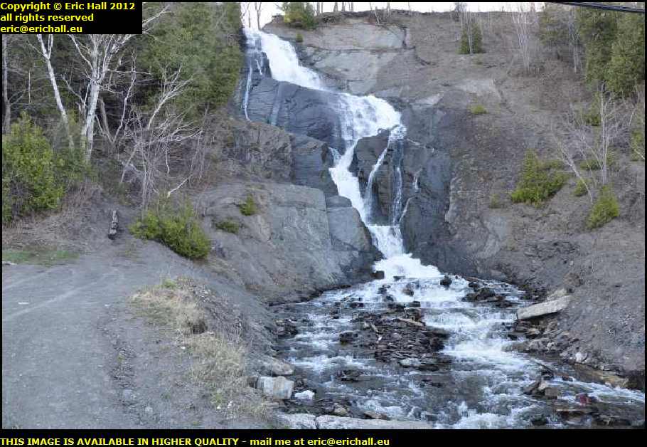
A short way out of St Petronelle on the way back to the bridge I encounter a waterfall cascading down the side of a rocky slope. It's hardly the Chute de Montmorency of course but in the absence of a decent photograph of that, this will do quite nicely. It's quite impressive in its own right.
One thing of course that has to be said is that now that I have in fact discovered the waterfall, this island has absolutely everything and I'm glad that I took the hour and a half out of my journey to come for a drive around.
I still haven't found a decent spec for a photo of the view of the waterfall at Montmorency but there's a handy parking place at the island end of the bridge. What I decide to do therefore is to park up here and walk along the bridge until I have a good view.
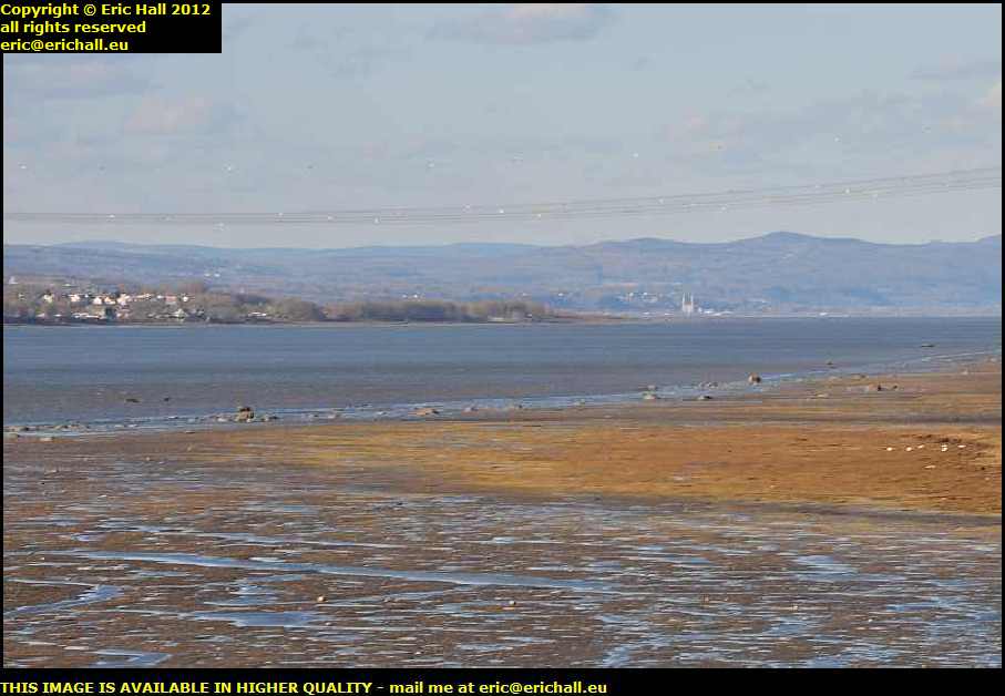
From along the bridge though there's an excellent view of Sainte Anne de Beaupré way, way in the distance along there. It was worth the walk along the bridge just for this photo. It's really come out well.
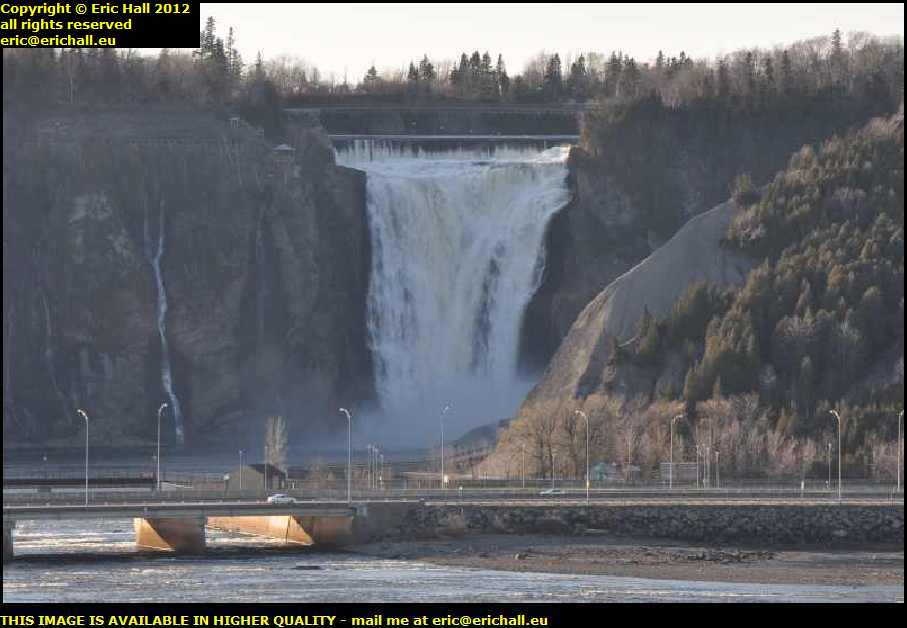
So there's the shot that I have been trying to get for about 10 or 11 years. I had to walk a hundred blasted miles for it from my parking space and so I hope that you are all grateful.
The Chute de Montmorency has a drop of about 83 metres which, strange as it is to say it, is about 30 metres higher that those of Niagara. Nevertheless, despite the height, it's nothing like as impressive and costs almost twice as much to park your car.
Champlain named these falls in honour of Charles, the Duke of Montmorency who was the Governor of Nouvelle France between 1620 and 1625. It's hard to believe that Cartier sailed up here in the 1530s and didn't give them a name. He surely must have seen them.
Prior to the tourist attraction of the site, there was quite an industrial complex here. Hardly surprising given the energy that must be contained in the water that falls down there. 35,000 litres per second on average, but during the spring meltwater season, they've recorded as much as 125,000 litres per second. There have been watermills, water turbines and a few hydro-electric installations along here in the past.
It was said originally that the falls were right on the shore of the St Lawrence but now they are some 50 metres or so away. Then again, you know my theory about the course of the river slowing changing towards the south
Having done my little bit about photographing the Falls of Montmorency I walked back to the car. You may remember that I'd parked the car on the island and walked some way over the eastern side of the bridge to find a good spot for the photograph, and so I walked back on the western side.
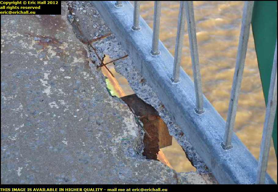
This doesn't look very healthy now, does it? A gaping hole in the pavement where the concrete has rotted and fallen through the deck. With the exposed steel grillage now acting as a conduit for oxidation, then the concete won't even need to rot in order to fall off the bridge and so this hole will expand rapidly.
That's not going to be a pleasant thought for anyone passing over a high bridge with a freezing-cold waterway flowing by underneath.
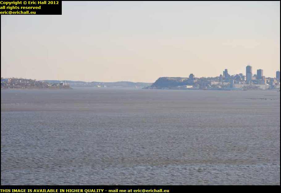
But anyway, this was the view that I really wanted. You can see straight away exactly why the Québec citadel and the possession of the headland of Cape Diamond are crucial. They are definitely the key to the control of the St Lawrence and the main trading route to the major centres of population.
It's here where the St Lawrence narrows and anyone who wants to sail higher up towards Montreal and the Lakes has to run the gauntlet of any guns on Cape Diamond and on the headland across the river at Lévis. Any decent army, well-led and properly supplied, could hold out up there for years
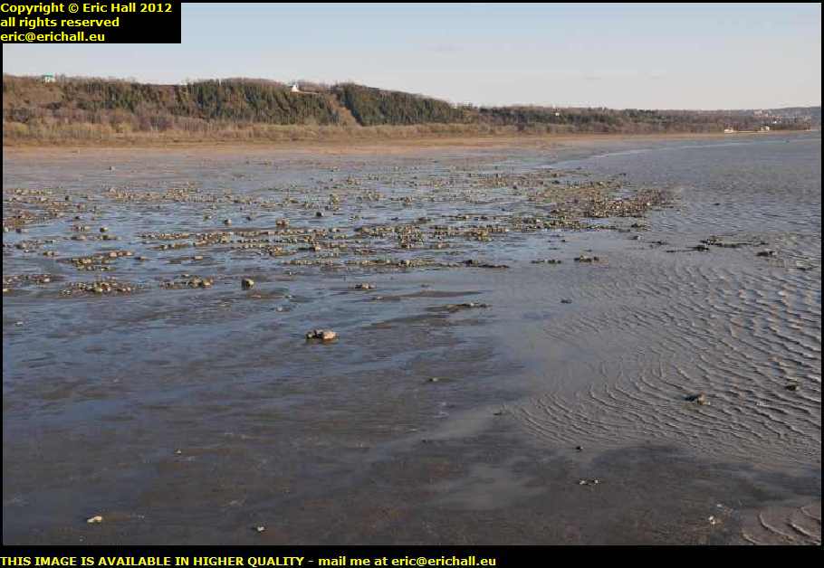
They reckon that the tidal point of the St Lawrence is about 10 or 12 miles farther downriver, although if you remember our visit just now to the Pont de Québec , there's certainly reference to the presence of tides further up river at the bridge.
But anyway, this part of the river around the Ile d'Orleans is known as the brackish zone, where the salt water being carried up with the tide mingles with the fresh water being brought down the river by the current.
So that was the Ile d'Orleans then. It's now early evening and having been promised the weather for tomorrow, I'm heading back into Québec and the Street of 200 Motels. I intend to fulfil the ambition of a lifetime (well, 11 or 12 years or so) and spend a day walking around the city.
©