 | CANADA |
OVER CAP TOURMENTE
Having just spent an exciting hour or so around the town of St Joachim and the foot of the Cap Tourmente, it's time to rejoin Highway 138, the road that essentially follows the north bank of the St Lawrence.
Having discovered (well, not really - I knew this anyway beforehand) that it isn't possible to drive along the foot of Cap Tourmente, then the only way to go is up and over the top.
The climb up the hill is really quite steep, and we go quite high too. It's no surprise that before we've actually travelled too far up the bank, we start to run into traces of snow still lying at the side of the road where the sun has not been able to reach it.
This is all looking quite ominous. Winter is still with us.

Halfway up the bank there is a choice of direction to take. And I mean a choice too, because both roads lead the the same place and eventually join up again.
The modern road that you can see turning to the right (we are looking back downhill in the direction from which we travelled) is one way to go of course, but the old road, the rather aptly-named Avenue de la Montagne that is effectively straight on over Cap Tourmente, is much steeper and much higher, and accordingly much more interesting.

From a little farther up the hill, you can see what I mean about things being much more interesting. We have left the coastal plain well behind us and we are climbing into the mountains of the Bouclier Canadien - the Canadian Shield - via the top of Cap Tourmente.
There is no word to describe the view except perhaps "stunning". It has to be probably the best view in the whole of Canada, if it wasn't for the power lines and don't get me started on all of that again.
The benefits of having a decent camera
and
an expensive high-quality lens
means, as you already know if you are a keen follower of these pages, is that you can crop, enlarge and sharpen to your heart's content, producing stunning enlargements from obscure corners of an image, and here are two examples to prove the point.
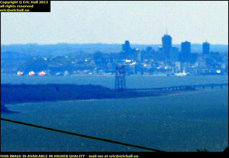
What we have in the image just here on the left is a view cutting right across the corner of the Ile d'Orleans where we were on Saturday, over to Cap Diamant and the old city of Québec.
You can even see the Amundsen and her colleagues from the Department of Fisheries and Oceans moored at the quayside where we encountered them yesterday afternoon
.
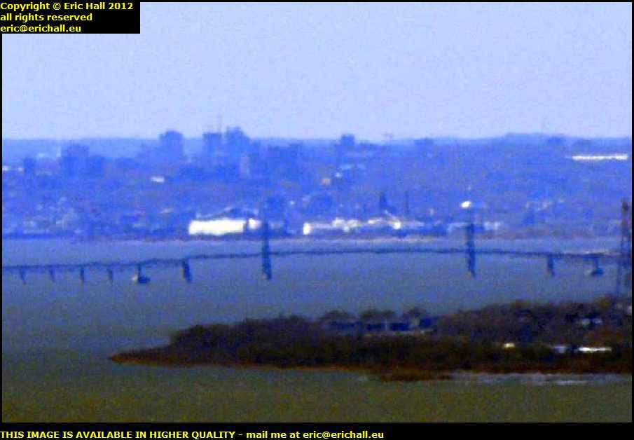
In this selection, we have a view of the newer part of the city around the Grand Allée, and also a splendid view of the Pont d'Orleans over which we drove on our visit to the aforementioned isle.
As an aside, if you want to see this photo from the reverse angle, you need to look at this particular photo taken from the walls of the city of Québec , or even this one taken from the Pont d'Orleans itself . I'm up there in those hills somewhere and that should give you some idea of how far away from the city and how high up I was when I took the above photo.
A short distance further on, we pass over the crest of the rise and we are presented with a totally different scenery. With the granite and the rocks and the rocky ooutcrops and so on this is certainly the outback or the wilderness or whatever you want to call it.
The scenery is totally different here. We have the typical Canadian rural settlements together with evidence of large-scale agriculture. Quite a pastoral scene, you might think, and you might also totally forget that you are a couple of thousand feet up in the mountains.
We haven't finished climbing either, because you can see in the distance the road going way, way, way off right over there into yet more mountains and that's the road that we will be taking.
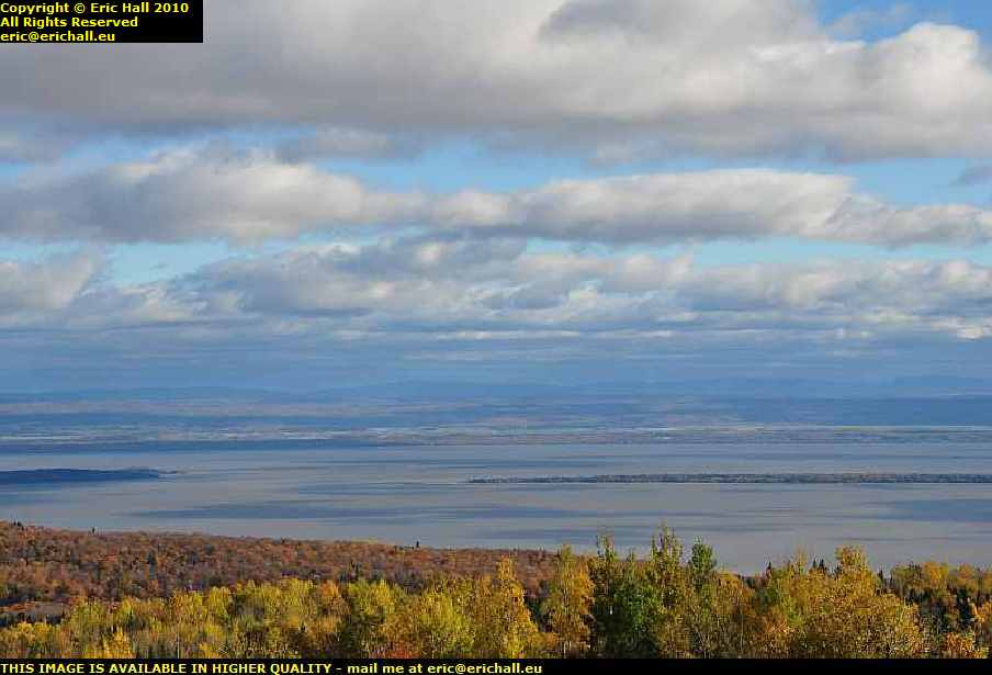
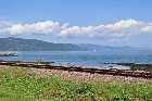
The view over to the right is also impressive in its own right. It needs no introduction of course because we shall be spending much of our time from now on either following the St Lawrence down to its gulf, or else we shall be sailing over it on a ferry or two.
The St Lawrence widens out after Québec and it's here that the views of the river start to become quite spectacular. So if you think that this view is good, let me just say that there's much better yet to come.
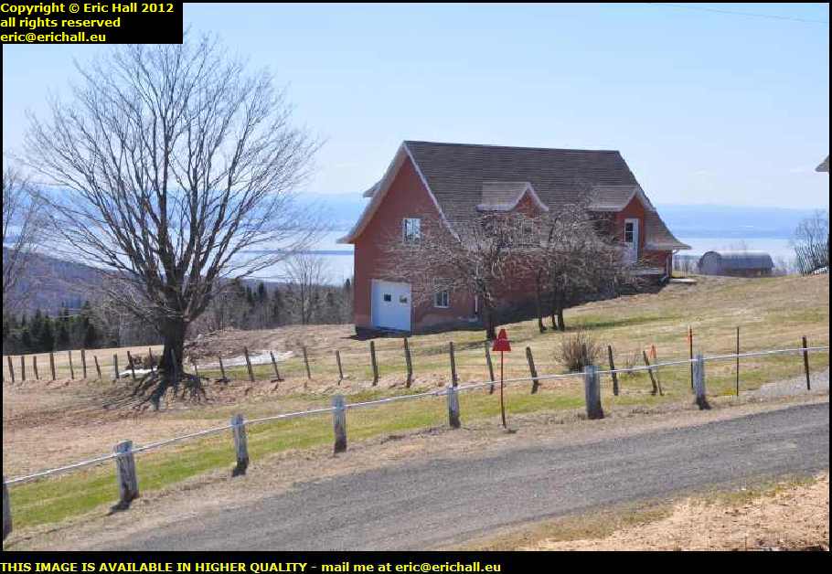
From the same viewpoint, looking over my right shoulder, you can see that some lucky person has built a house in a field here on the headland overlooking the St Lawrence. The view out of his living room must surely be one of the best views in the whole of Québec.
There's a notice posted to the effect that this is all private property and I cannot say that I'm surprised. If I had a view like this, I would want to keep it all to myself too.
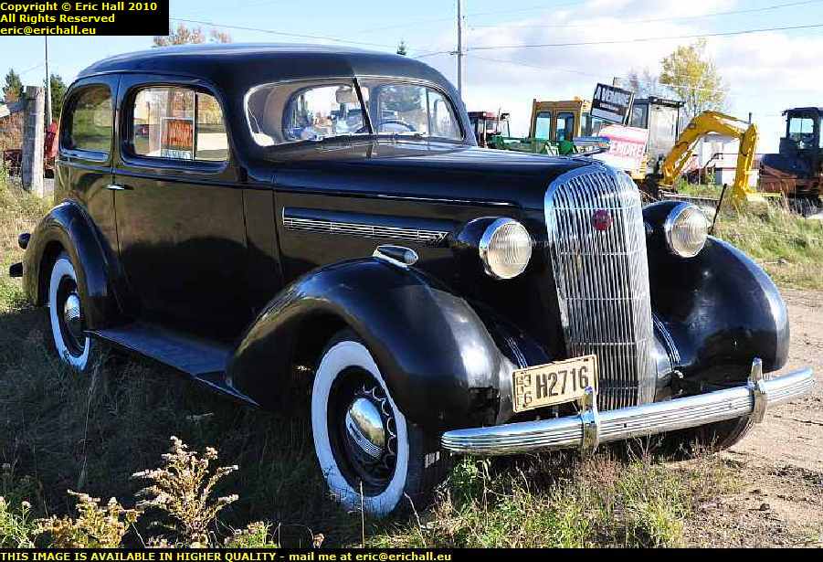
We haven't finished with the excitement yet, though. At least, back in 2010. Just where I'm about to rejoin the main highway after the scenic diversion via the Avenue de la Montagne, we encounter another fine example of North American motoring history.
This is an old Buick 8, and I made a mental note that it dates from 1936, although I can't remember now how it was that that date came into my head.
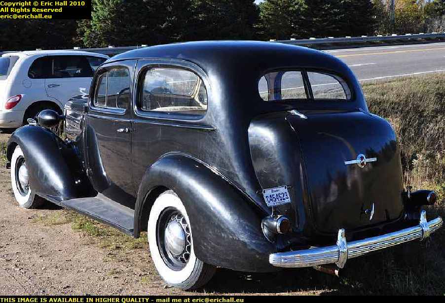
Of course, me being me, I had to stop for a good look around and you will probably notice Casey, my trusty steed, in the background
It turns out that the Buick is for sale, but with no indication of the price. It really is beautiful and I'd love to take it home with me, but it's one of those "Rolls-Royce" moments where "if you have to ask the price, you probably can't afford it", especially when you have to stick $1000 on the price to ship it back home.
A short while ago, you will have seen a photo that I took from the top of Cap Tourmente looking across a beautiful pastoral scene to the mountains in the distance.
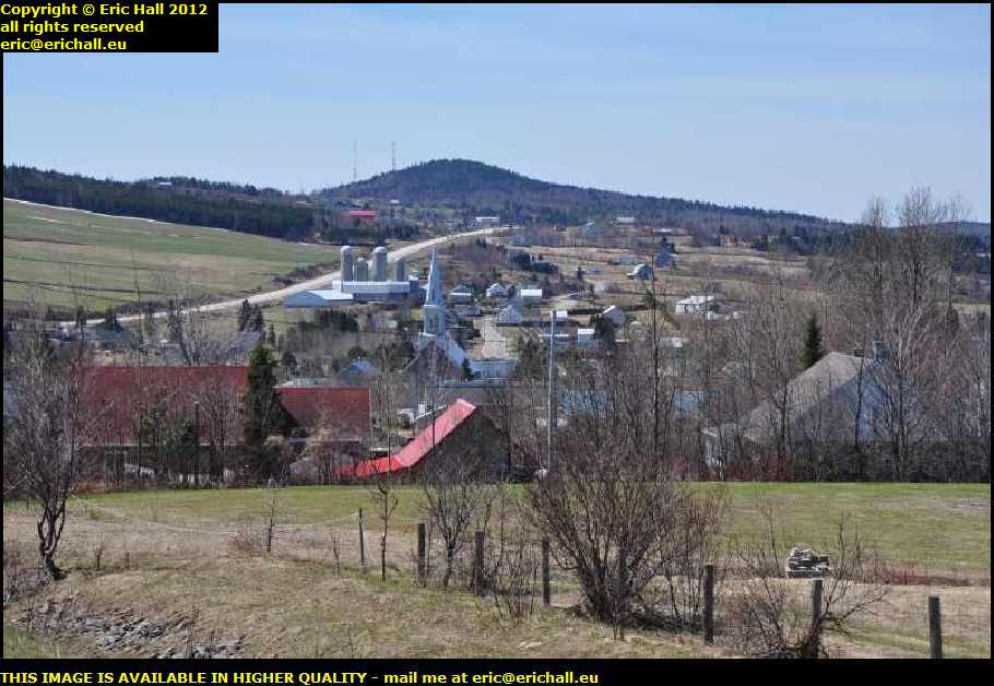
Here is the view from the reverse angle looking back across the valley to where I was earlier when I was coming over the Cap Tourmente by way of the Avenue de la Montagne
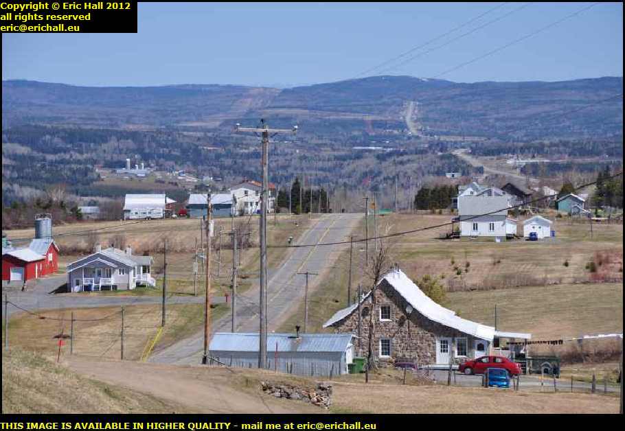
The village that you see is called St Tite des Caps, the Caps, or "Capes" being not necessarily Cap Tourmente, but being the official name of this part of the Province of Québec.
St Tite des Caps is, surprisingly, comparatively modern and dates from the 1870s although there was some kind of religious mission established here in 1853.
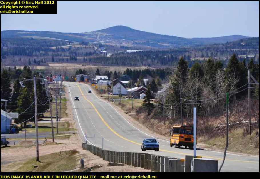
A little way further up the hill we strike it lucky with a parking place (which are few and far between in Canada, it has to be said) where the view back towards where I came from is even better.
You can see the road over which I have just driven, and in the centre of the photo in the distance, nestling discreetly in a little hollow, is the town of St Tite des Caps.

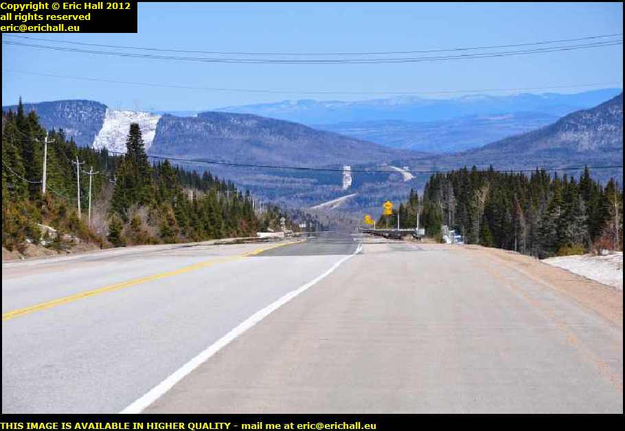
In the other direction, the one in which I'm heading, I'm returning to the mountains. You saw them in front of you in one of the photos a few minutes ago. And this is propbably one of the most stunning, spectacular views that you can ever expect to see, especially in the late-morning sun of October 2012.
Strawberry Moose will be enjoying it too, because, as you can see, he can reasonably expect to be seeing some of his transatlantic cousins. This part of the highway is protected by a moose net for several kilometres but nevertheless, the sign warns that close encounters of a moose kind might be reasonably expected.
The view from almost the same viewpoint at roughly the same time in April 2012 is a little different however, but one thing that doesn't change is that it's here where the exciting bits start to happen. There's almost nothing now until you go right over the top and down the other side to Baie St Paul and back at the beginning of November 2011 I saw the weather that they were having up here. I had been wondering if late April would be as bad?
Another thing worthy of mention is that from here, it's all downhill apparently and at an average of 7% over 20kms too, which over that kind of distance is phenomenal by anyone's standards.
Before I leave this page and go off somewhere else, I thought that I would leave you with this photo, taken a little further along the road in April 2012.
The road up into the mountains has taken us to an altitude of 740 metres, just like the Font Nanaud back home in fact - "the Font is actually 739 metres" ...ed.
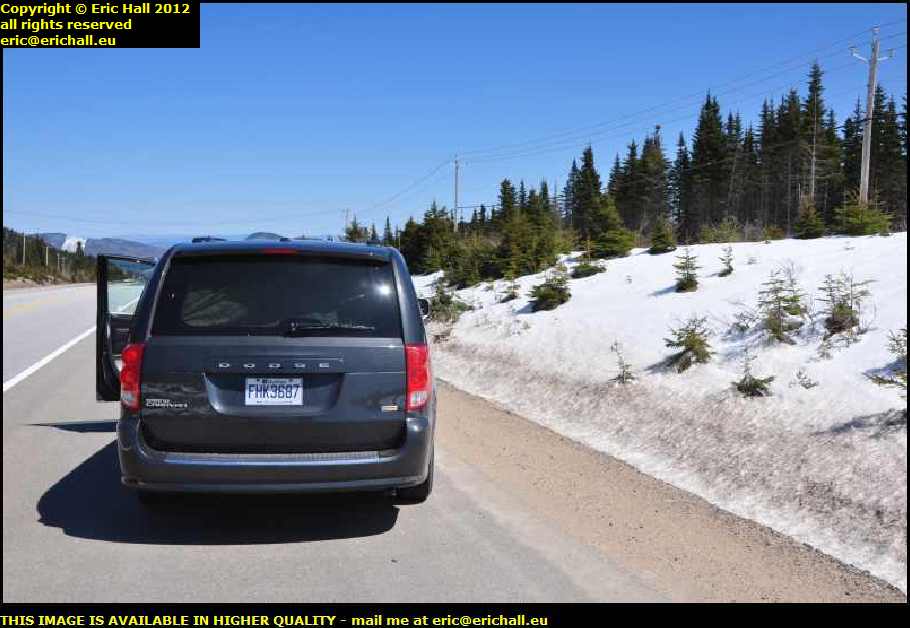
Where the sun can't get in between the trees in the forest at the side of the road there are piles of snow not yet melted, but it's not so bad on the sides of the roads, even when you start to climb higher up the mountain.
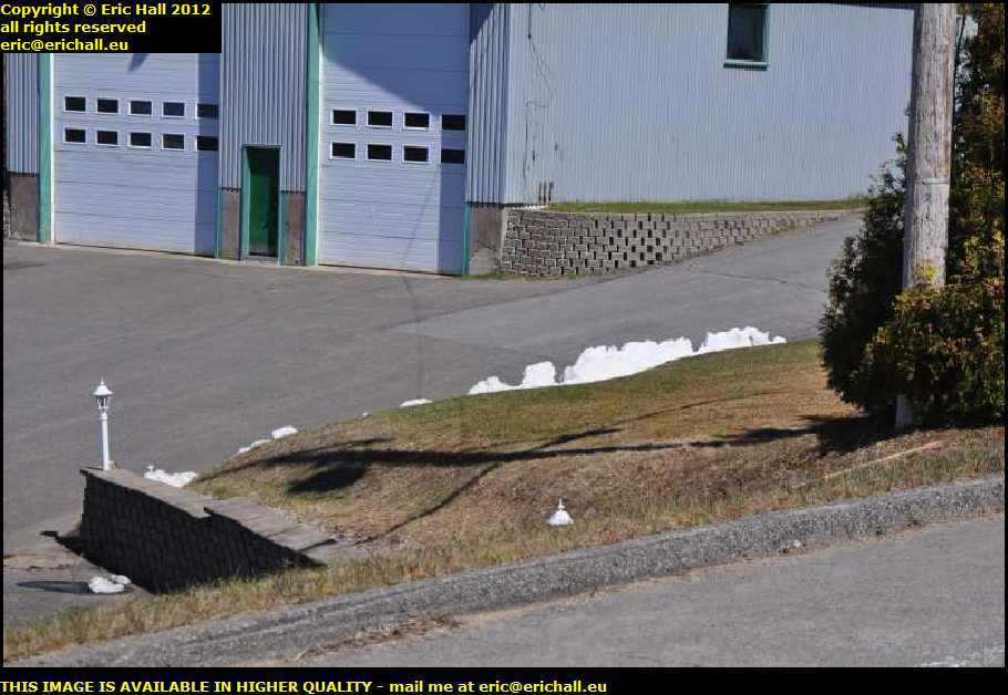
However, right by mile marker 433, there is a suitable place to stop where you can see how much snow there is around here. I thought that I would throw in this photo at this point to give you some idea of the weather conditions that I was hoping to have further along the route.
©